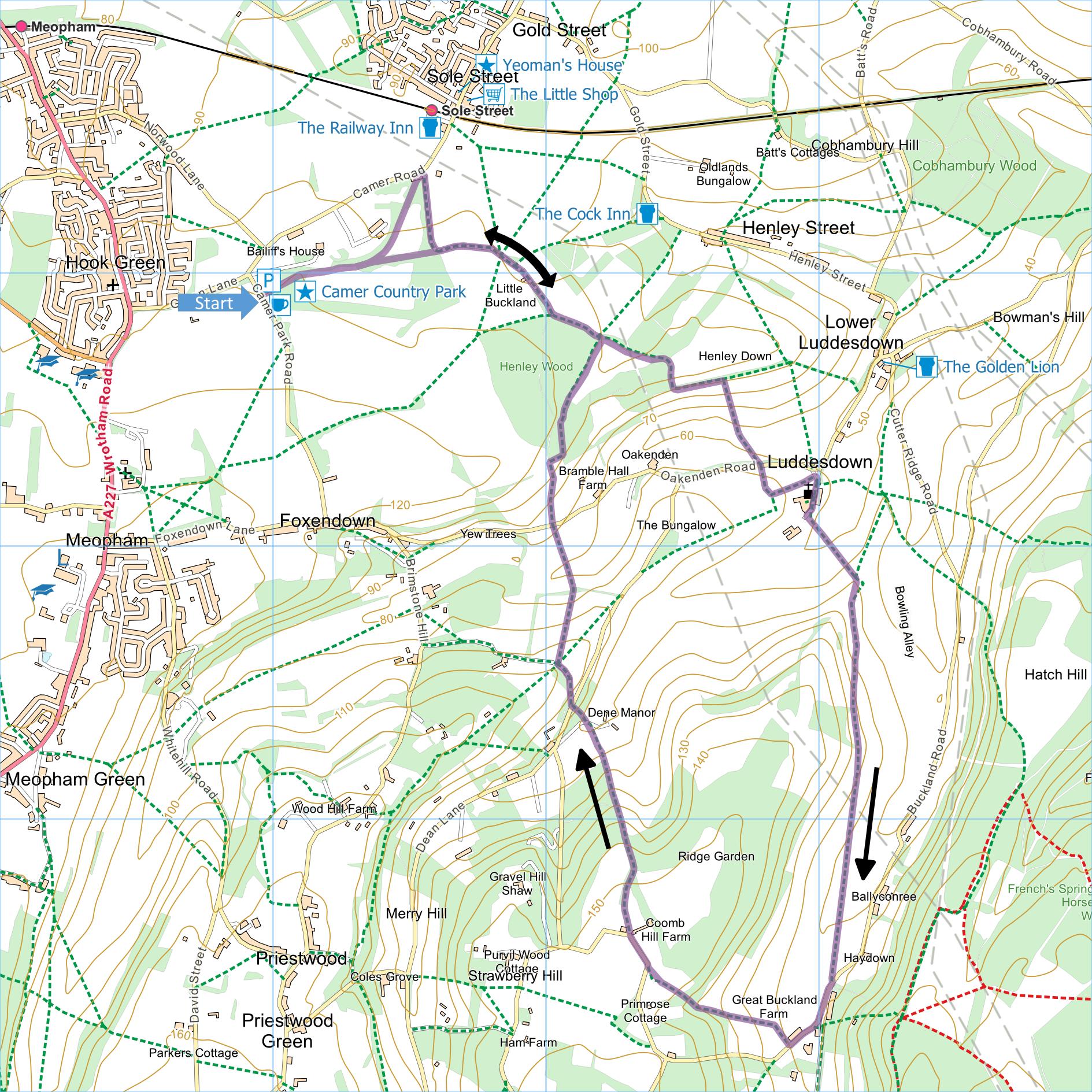
Camer Park & Luddesdown
Distance: 6.2 miles
OS Map: Explorer 163 (Start at grid reference
TQ64669)
Click map to enlarge and click
again to enlarge further
Start from free car park in Camer Country Park.
Head directly away from entrance of car park along
clear track, keeping left to remain parallel to park
boundary on left. Emerging through gate and past
East Lodge at bend in road, turn right onto track
(Wealdway), keeping right with woodland on right and
open fields on left. Follow track round left hand
bend then gently right past a couple of houses.
After section of woodland on right, keep forward at
cross paths and follow left hand edge of open field
under power lines then through short section of woodland
into vineyard. Head down right hand side of vineyard to
gate and steps into field. Turn left along top of
field, soon becoming a vineyard, and 190 metres from
corner (70 metres from start of vines) at bench on left
turn right down path through vineyard. Beyond
bottom, head uphill keeping to right of line of trees
ahead. Go through gate and woodland to emerge
through hedge onto Oakenden Lane.
Go straight across up steps, cross field to
protruding corner of hedge and turn left with hedge on
right. Continue to corner, down steps and emerge
at junction of lanes at Luddesdown. Turn right
along private drive past church on right and old barn on
left. After right hand bend in drive go through
gate on left into very small field downhill linking to
larger field.
Head to top corner of field past metal gate on left,
bear right then go through second metal gate (adjacent
to field gate) into vineyard. (At certain times
you may be asked to bypass the field by going on the
other side of the hedge along the right hand edge of the
vineyard, which is actually where the recorded public
right of way goes.) Bear right, initially uphill,
along top of vineyard for 530 metres then pass through
metal gate into meadow. Bear slighty left to gate
and in next field follow gently descending path parallel
to vineyard on left. At next gate enter another
vineyard now with vines on both sides; continue to gate
40 metres to left of corner and go up steps into
Buckland Road.
Turn right to road junction then right down Lockyers
Hill. Immediately after Great Buckland Farm take
path up steps on right, go over stile and across field.
Bear diagonally right across corner of field, over stile
then turn left up grassy strip between fields. On
reaching corner of woodland maintain direction up left
hand edge of next field and at corner enter wood.
Emerging from top of wood into field, bear left across
field to stile and maintain direction across next field
to lane at corner.
Turn right and at first corner go ahead keeping to
right of black and white timber-framed Coomb Hill
Farmhouse. Follow track bearing slowly right.
On reaching second gate on right go forward remaining
inside woodland but with large open field over fence on
right. At bottom of wood go over stile and
straight down field keeping to right of tennis court.
Go over stile, across drive, up grassy bank and take
path initially alongside fence into wood. At top
emerge onto lane (Dean Road).
Bear right and take byway leaving lane at angle on
left climbing with wood on left and field on right.
Follow round to left at top and go through kissing gate
on right into field. There are two paths across
field – take left one heading over brow of field and
disappearing from sight towards hedge at bottom.
Through kissing gate in hedge head up field towards gate
in middle of top edge to right of large barn. Go
through kissing gate onto Oakenden Road.
Go through kissing gate opposite and follow path
alongside fence on right. Cross next field to top
right corner and go through kissing gate into wood.
Keep right at first junction and go straight across on
meeting broader track. On far side of wood, follow
left hand edge of field past equestrian jumps to corner.
Turn left along track now retracing steps from start of
walk. Follow track, pass buildings on left, pass
junction of paths across open fields, bear left and when
track turns sharp right go forward through kissing gate
hidden in bushes back into Camer Country Park.
Keep going straight forward through trees then across
grassland back to car park.
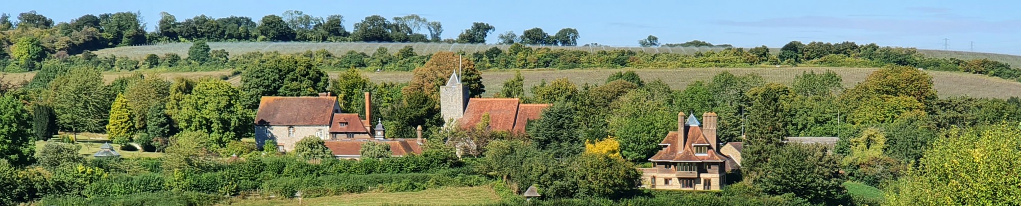
Thanks to Jack Yan for the photograph used for this
page's banner.
|
Points of Interest
Camer Country Park
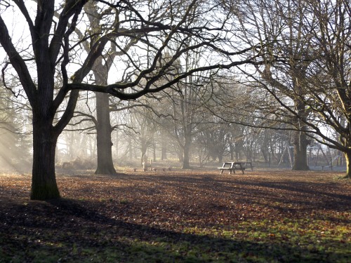
The park covers 46 acres of parkland and woodland and
there is a small café. It is noted for its wildlife,
particularly slow worms and common lizards. The park is
very popular with dog owners, which some visitors find
off-putting. The mature parkland was once the
grounds of Camer House, formerly the home of the
Smith-Masters family built in the 17th and 18th
centuries and now Grade II listed. The estate was sold
to Strood Council in 1967 and later transferred to Kent
County Council but the house was retained in private
ownership and is now divided into several dwellings.
Luddesdown Church

Much of the church was 14th century or earlier until
the nave roof collapsed in 1865. The church was
rebuilt and decorated with wall paintings which remain
its outstanding feature. Unfortunately it is
difficult to find a time when the church is open other
than for services and specific events.
The Wealdway
From the lodge at the edge of Camer Park all the way
to Great Buckland Farm, this walk follows the
Wealdway, an 82 mile
walk from Gravesend to Eastbourne across some of our
finest countryside.
Public Transport
The most northerly point of the walk is just 300
metres from Sole Street station. Alternatively you
can walk from Hook Green which is served by the 308 bus
from Borough Green (not Sundays).
Please report any problems with this walk to
info@kentramblers.org.uk.
Ramblers' volunteers in Kent work tirelessly to
ensure that our paths are as well protected and
maintained as possible. Of course we also organise
led walks but most of our members are independent
walkers who simply want to support our footpath work.
Please
join us and become a supporter too. You need
us and we really need you.
Map contains Ordnance Survey data © Crown copyright
and database rights 2023. Some paths on map are based
on data provided by Kent County Council but do not
constitute legal evidence of the line of a right of way.
In addition to the walking routes on our web site we
have published three popular walking guides:
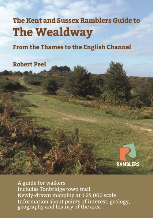
Guide to the Wealdway

Guide to Tunbridge
Wells Circular Walk and other walks in the area

Guide to the
Kent Coast Path: Part 1, Camber to Ramsgate

Guide to Three
River Valley Walks in West Kent: Darent Valley Path,
Eden Valley Walk and Medway Valley Walk
|