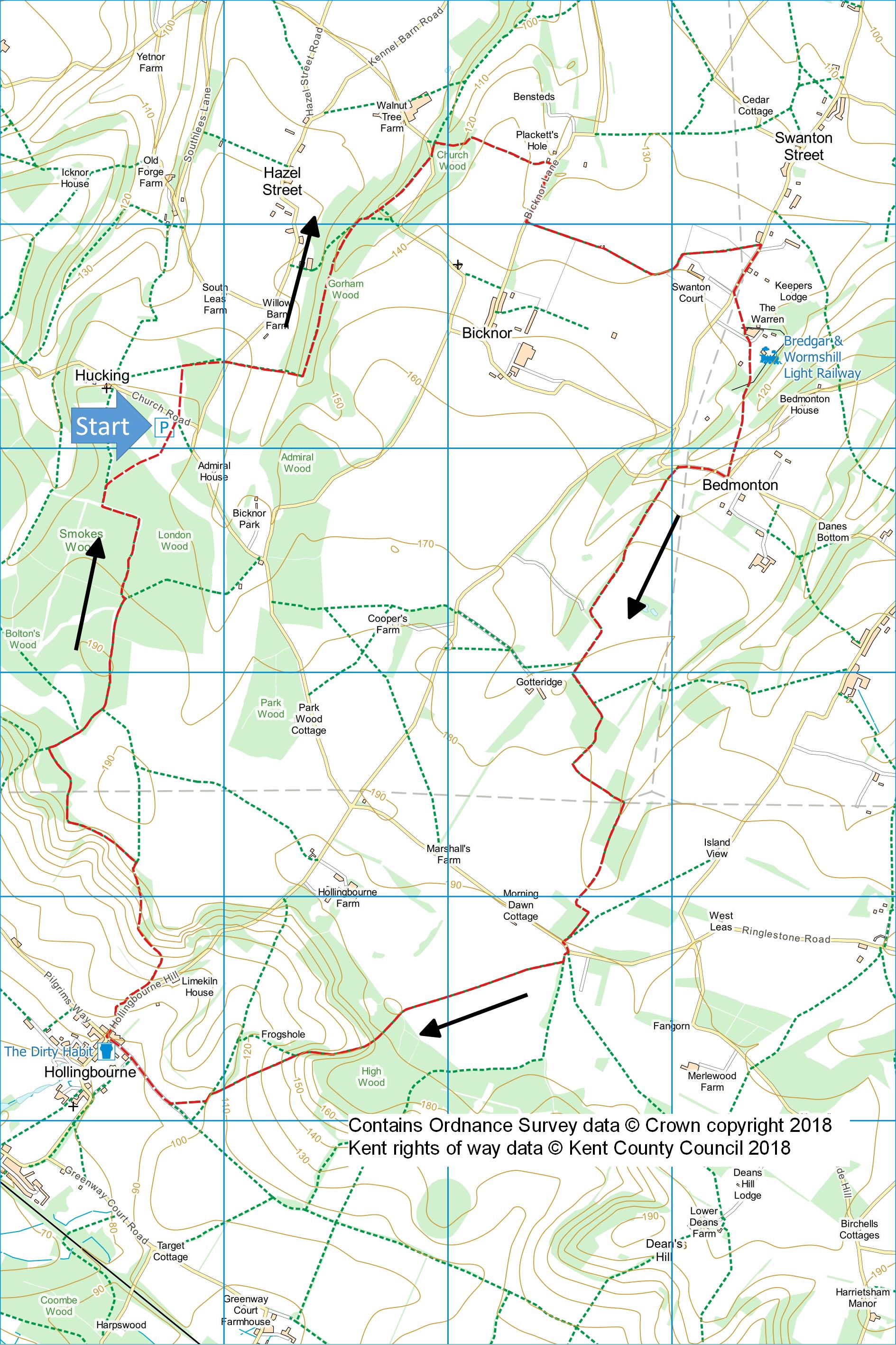
Hucking and North Downs
Way
Distance: 8.8 Miles (4.5 Hours)
OS Map: Explorer 148 (Start at grid reference
TQ848581)
Click map to magnify and click
again to magnify further
Park in Woodland Trust car park on
Hucking Estate.
The location is can be reached from junction 8 of
M20 by taking A20 towards Lenham, first left through
Eyhorne Street and Hollingbourne, follow signs to
Hucking then Hook and Hatchet into Church Road when the
car park is soon on your left.
Cross Church Road and go over stile
into meadow.
There is no path but walk parallel to right hand fence
and make for metal kissing gate through fence about
halfway down.
Through gate, follow track through new woodland
to lane.
Take path opposite.
Follow right hand edge of field to gate.
Through gate, go straight down to another gate
then down to bottom of dry valley.
Turn left along valley bottom through wood,
keeping left at fork, to lane.
Take path into wood opposite and
soon take a path on right to climb steadily through wood
to a field.
Go straight across until you reach a stile.
Over stile, bear left to far corner of field and
over stile into lane.
Turn right and follow lane until
there is a path through a gap in a hedge just before a
locked gate.
Take path uphill with hedge on right and cross orchards.
Keep going in a straight line until you are on a
stony track that starts to curve left.
Follow round the curve with the garden of Swanton
Court on your right.
At end of garden go through gate into field and
cross diagonally to point where line of pylons crosses
hedge.
Search for stile in hedge and on the other side bear
right across paddock to another stile into lane.
Turn right along lane then,
immediately opposite driveway to Swanton Court, go over
not very visible stile in hedge.
Cross field diagonally, go through gate just to
right of sheds and cross railway to stile.
Cross drive and two more stiles.
Maintain direction diagonally across field to far
corner and cross railway again, keeping to left of
station.
Descend bank to wooden gate then cross hawthorn scrub to
another wooden gate.
Cross next field diagonally right, climbing to
stile at highest corner of field.
Turn right down lane and just
before the valley bottom take track on left through
trees. On
reaching asphalt track cross it and go through gate.
Follow track across fields, turning left at
corner and after a while re-entering woods through gate
on right.
Follow track for further half mile to lane.
Turn left then take track past
barrier on right.
After about forty metres take footpath on right
(waymark needed here) through hedge then diagonally
across field for half a mile into wood.
Follow track downhill through wood, soon offering
fine views of North Downs on right.
On emerging from wood head downhill diagonally
across field to hedge.
Continue through hedge, down steps, across track
and diagonally across field to lane.
Turn right and continue into Hollingbourne.
Turn right uphill at the crossroads and take a
path up the bank on the left just before the “National
Speed Limit” sign (white circle with black diagonal
bar). Follow
right hand edge of field to gate then bear left steeply
uphill to North Downs Way post.
Turn left and follow NDW until you re-enter the
Woodland Trust’s Hucking Estate.
Turn right, leaving NDW which goes left, along
broad track passing an old chalk pit inside a fenced
area. When track
bears right, take path on left then almost immediately
go through gap by gate on right.
Follow track, which in 350m or so turns
left and at first junction turn right.
At sign take path through gate on right back to
car park.
|
Points of Interest
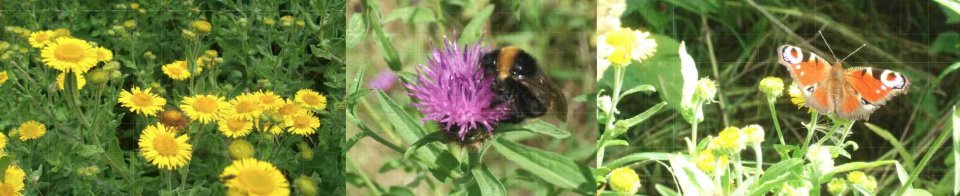
Hucking Estate
Bought by the Woodland Trust in 1997, the farmland is
being returned to woodland and chalk grassland to
encourage restoration of classic downland habitat.
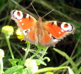
Peacock butterfly at Hucking
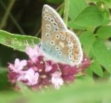
Common blue butterfly at Hucking
Bredgar & Wormshill Light Railway
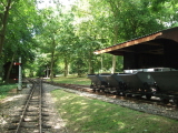
A train set to envy. More details here:
http://www.bwlr.co.uk.
Hollingsbourne
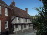
Attractive old houses and a pub, The Dirty Habit, the
name perhaps reflecting the state of dress of travellers
on the adjacent Pilgrims Way.
In addition to the walking routes on our web site we
have published two popular walking guides:

Guide to the
Kent Coast Path: Part 1, Camber to Ramsgate

Guide to Three
River Valley Walks in West Kent: Darent Valley Path,
Eden Valley Walk and Medway Valley Walk
Ramblers' volunteers in Kent work tirelessly to
ensure that our paths are as well protected and
maintained as possible. Of course we also organise
led walks but most of our members are independent
walkers who simply want to support our footpath work.
Please
join us and become a supporter too. You need
us and we really need you.
Map contains Ordnance Survey data © Crown copyright
and database rights 2018. Some paths on map are based
on data provided by Kent County Council but do not
constitute legal evidence of the line of a right of way
|