Four Churches Walk: Barham, Womenswold,
Bishopsbourne & Kingston
Distance: 7.5 miles (3h 45m)
OS Map: Explorer 138 & 139
(Start at grid reference TR 208500)
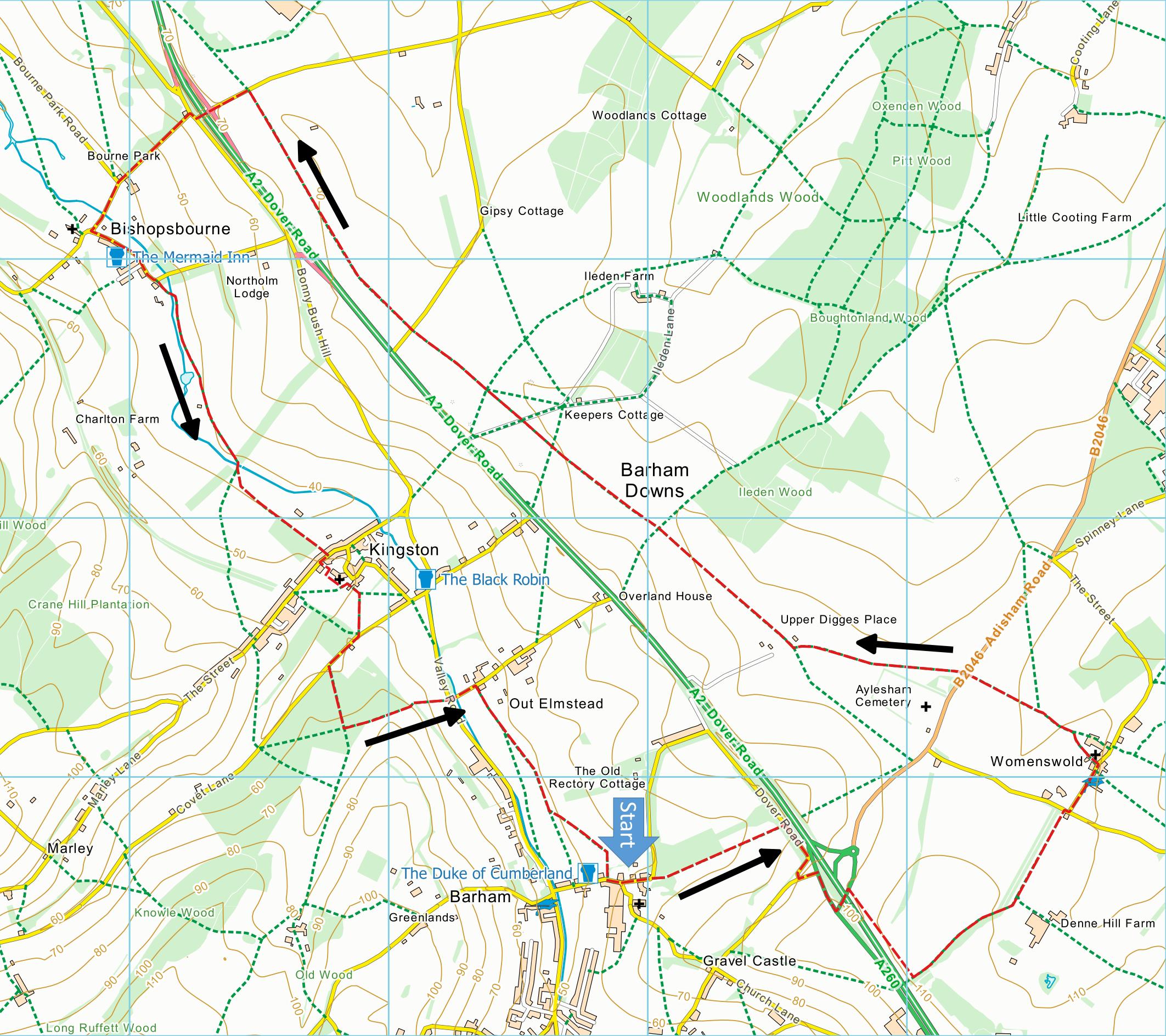
Click on map to enlarge and then again to enlarge
further.
Start at any of the four churches for a circular walk.
These directions assume you start from Barham.
One short hill. Muddy in places after rain. Park
near Barham village green.
Barham to Womenswold 1.6 miles (allow 50 minutes).
1. From the porch of St John the Baptist in Barham go
through the lych-gate and turn right and then right
again into Rectory Lane.
At the first bend go straight ahead, past garages and
through a kissing gate onto a footpath. Go ahead
keeping fence on right hand side and avenue of lime
trees to the left, to a field boundary where straight on
across the field to a stile and short steep incline over
a stile onto old A2. Turn right and continue along this
road to a T-junction. Cross road onto pavement and turn
left following pavement round to the right to walk up to
flyover over A2.
2. After crossing A2 turn right onto a signed bridleway
alongside and above the A2. After 400 yds at finger
post turn left onto bridleway through a field and follow
track, keeping wooded area on your right. After 400 yds
the track curves right to pass through trees and just
beyond this turn left where tracks cross.
Straight ahead to North Lodge where you turn right
and immediately left into Womenswold. Continue to
church on left.
Womenswold to Bishopsbourne 3.2 miles (allow 1½
hours). Grid Ref TR227504
3. Facing away from the porch of St Margaret’s turn
right, descend steps and proceed on footpath ahead.
This becomes a track which wanders left and right before
joining the North Downs Way. Continue on the North
Downs Way for 2.5 miles. The route is well signposted:
it crosses the Aylesham road (cross with care). About
400 yds beyond the road, watch out for the left turn
before a barn and a concealed right hand turn
immediately after the first white house.
4. After a further half mile fork left on a distinct
path across fields in the general direction of a
telephone mast – it is well signed. Continue along the
North Downs Way until you get to Cold Harbour Lane
where, on your left, you will see a bridge carrying the
A2 over Cold Harbour Lane. Go under the A2, cross the
road, and ahead down the road into Bishopsbourne.
Bishopsbourne to Kingston 1.2 miles (allow 40 minutes).
Grid Ref. TR187526
5. From the lychgate of St Mary’s go ahead along The
Street to the village sign for Bishopsbourne on a left
hand bend. Go ahead here on a tarmac bridleway.
6. After half a mile, on a right hand bend, go
ahead through a gate into a field, signed bridleway 274,
and continue over a footbridge and through two iron
gates along the floor of the valley. At the road turn
right and then left behind ‘The Barn’ to take the path
to the churchyard.
Kingston to Barham 1.5 miles (allow 45 minutes). Grid
Ref TR198512
7. Facing away from the gate of St Giles’ churchyard
into Church Lane, turn right and then almost immediately
left along a nearly hidden footpath to a gate. Go
through the gate and diagonally right to a second gate
and continue to stile by old railway bridge. Over stile
and turn right, under bridge and past water works.
8. Then turn left along a bridleway (marked also private
road to Hearts Delight).
After 250 yds turn left at cross tracks (blue
marker post) to a gate. Go through gate, over brow of
the hill and continue to Valley Road. Cross (with care)
and continue along Out Elmstead Lane to turn right on
public footpath just before first cottage.
9. Continue straight ahead through fields to second
stile. Cross the stile and fork left, aiming left of
the spire of St John the Baptist, to a stile. Over
stile and on into The Street and turn left, following
the road to the church.
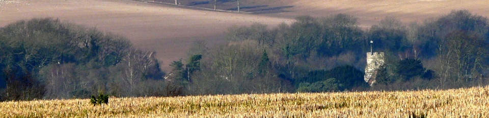
This walk was originally published on a calendar
produced by White Cliffs Group. Thanks to Andrew
and Sheila
Boultbee for originally devising this route and Andrew
Boultbee for the
banner photograph and for the idea. Thanks to
Diana Backwell for checking the route.
|
Places of Interest
Oswalds, a Grade II listed building just north-east
of Bishopsbourne church, was from 1918 until his death
in 1924 the home of Joseph Conrad.
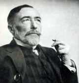
Here he wrote The Rover and the unfinished
Suspense.
In addition to the walking routes on our web site we
have published two popular walking guides:

Guide to the
Kent Coast Path: Part 1, Camber to Ramsgate

Guide to Three
River Valley Walks in West Kent: Darent Valley Path,
Eden Valley Walk and Medway Valley Walk
Ramblers' volunteers in Kent work tirelessly to
ensure that our paths are as well protected and
maintained as possible. Of course we also organise
led walks but most of our members are independent
walkers who simply want to support our footpath work.
Please
join us and become a supporter too. You need
us and we really need you.
Map contains Ordnance Survey data © Crown
copyright and database rights 2017. Some paths on
map are based on data provided by Kent County Council
but do not constitute legal evidence of the line of a
right of way.
|