Cowden Station &
Trugger's Gill
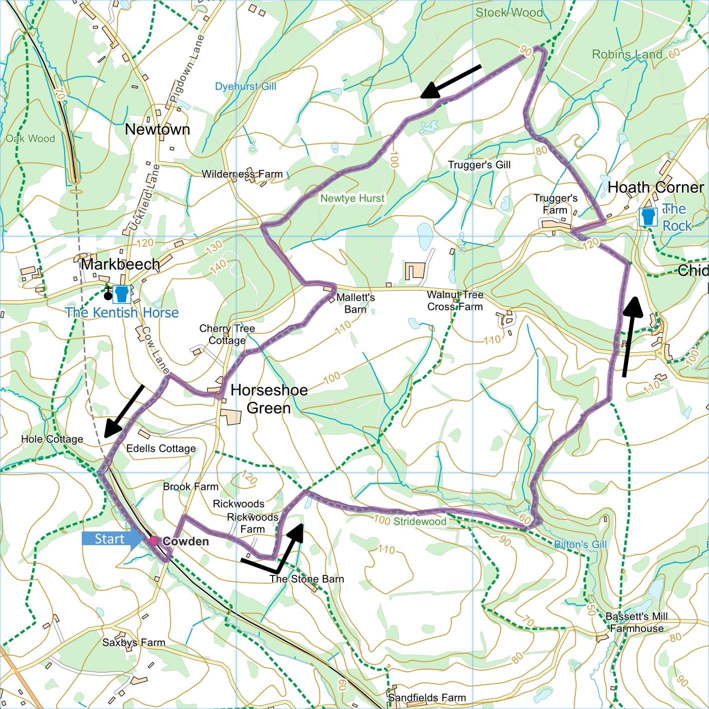
Distance: 5.4 Miles (2h 40m)
OS Map: Explorer 147
(Start at grid reference TQ476417)
Click map to enlarge and click
again to enlarge further
Park at Cowden Station. Alternatively travel by
train – there are services every day of the week.
From end of station approach go up Blowers Hill.
Take first turn on right (Wickens Lane, not named but
there is public footpath sign). Pass drives to
Rickwoods House and Rickwoods Farm; take next turn on
left.
Go up drive and, just before reaching house ahead, go
through gate on right and bear left diagonally across
field to gate in hedge. On far side bear right to
pass concrete water trough. Continue in the same
direction through two gates, over brow of hill and make
for stile into wood. Turn left along path through
wood to emerge over stile. Follow path along
glade, after a few minutes descending gently. At
lowest point before path starts to ascend and bear right
(alongside waymark post close to wood on right), bear
left to stile and enter wood. Cross footbridge and
bear left along path that soon bears right to climb
steeply through wood. On joining more level path,
keep left and continue to stile and gate into field.
Follow right hand edge of field to gate. Don’t
go through first gate but through kissing gate a few
metres beyond it leading into a small section of
woodland. Beyond the woodland follow right hand edge of
field to reach lane.
Take path opposite, uphill through woodland. Cross
field towards copse. Turn left following line of
electricity wires and making for gate immediately
beneath next pole. Follow path beyond gate down to
Truggers Lane.
Turn right for about 100 metres and at lowest point
of lane take path on left descending to footbridge.
Follow path between fences then along right hand edge of
a couple of fields to enter Trugger’s Gill. Go
over footbridge and up bank beyond into field.
Follow hedge on right until it turns right, then bear
half right across field, going neither uphill nor
downhill, to enter more woodland. At a T-junction,
turn left along broad track. Follow track through
wood and along ridge (initially lower Tunbridge Wells
sandstone and later Wadhurst clay mudstone), if in doubt
taking higher of alternative paths to ensure that you
remain on ridge until path enters Newtye Hurst Wood.
Follow track through wood to road.
Turn left and left again at junction. At
footpath sign on right, go down driveway towards
Malletts Barn. Just before gate, go right along
path between hedge and wall to gate (Buckhurst Farm over
wall is Grade II listed). Go straight across field
to gate. In next field pass to right hand side of
pond surrounded by trees and continue across field.
Aim just left of electricity pole and descend to gateway
in hedge. Immediately through gateway, go through
metal pedestrian gate on right and up field for about
100 metres to pole, then bear half left to gate in hedge
that leads into Station Road opposite white house with
hung tiles (The Old Bakehouse).
Turn left and soon right into Cow Lane. This
climbs at first but just as it levels out take path on
left steeply down right hand side of field, then over
stile and along end of garden of large house (Edells).
Another stile (with waymark) takes you into more
woodland and soon you see on your left brickwork at
entrance to railway tunnel. At T-junction turn
left and keep between railway on your left and stream on
your right until you reach Blowers Hill. Turn left
under railway bridge and left back into station
approach.
|
Points of Interest
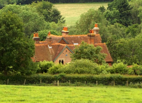
Buckhurst Farm (also known as Old Buckhurst)
This is a late mediaeval hall house with early 17th
century projecting gabled left extension. The
garden is sometimes open under the National Gardens
Scheme.
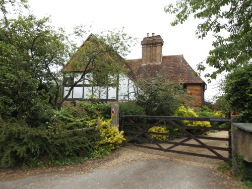
Edells
Built in the 1830s for William Woodhouse, a General
“in the Service of the Honorable East India Company”
according to his will proved in 1845. The
ten-bedroomed house, little altered since 1875, is now a
very up-market holiday let.
The Markbeech Riots
During the construction of the Markbeech railway
tunnel between Hever and Cowden in 1866 riots broke out
when about 500 French workers were brought in to
undercut the wage rates paid to English Navvies.
Public Transport
Good rail service to starting point.
In addition to the walking routes on our web site we
have published three popular walking guides:

Guide to Tunbridge
Wells Circular Walk and other walks in the area

Guide to the
Kent Coast Path: Part 1, Camber to Ramsgate

Guide to Three
River Valley Walks in West Kent: Darent Valley Path,
Eden Valley Walk and Medway Valley Walk
Please report any problems with this walk to
info@kentramblers.org.uk.
Ramblers' volunteers in Kent work tirelessly to
ensure that our paths are as well protected and
maintained as possible. Of course we also organise
led walks but most of our members are independent
walkers who simply want to support our footpath work.
Please
join us and become a supporter too. You need
us and we really need you.
Map contains Ordnance Survey data © Crown copyright
and database rights 2022. Some paths on map are based
on data provided by Kent County Council but do not
constitute legal evidence of the line of a right of way |