Joyden's Wood
Distance: 2.8 Miles (1.5 hours)
OS Map: Explorer 162 (Start at grid TQ507714 )
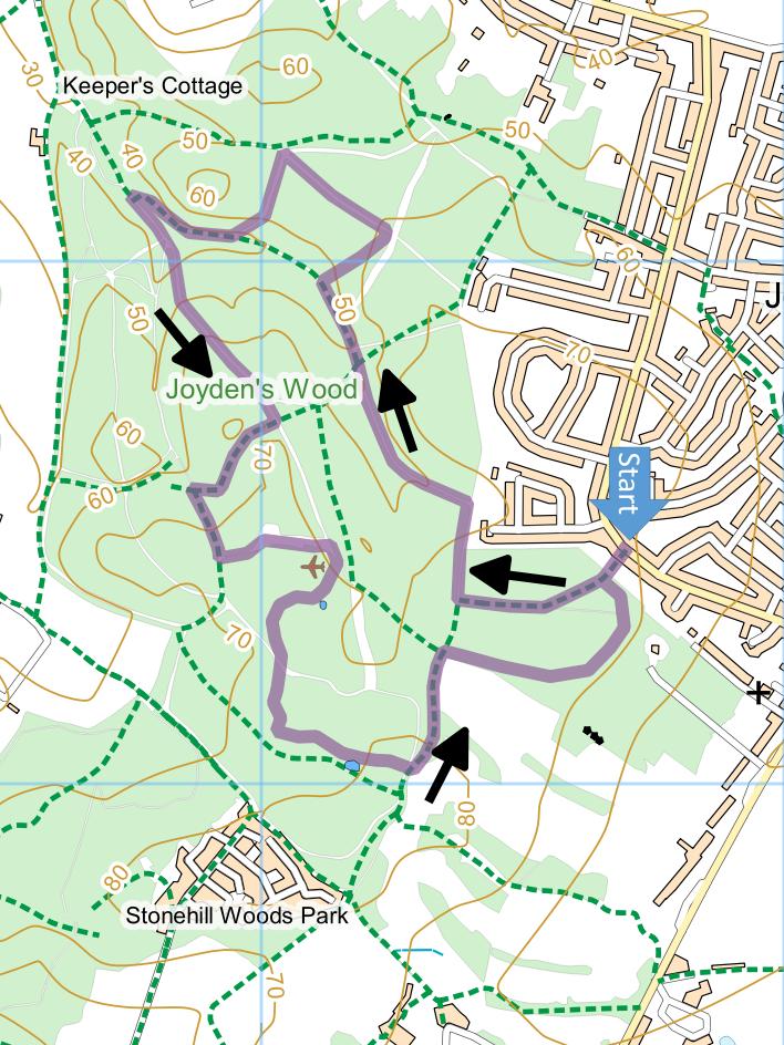
Click map to magnify and click
again to magnify further
Park in Summerhouse Drive.
From Orpington, go to Crittal’s Corner (by B&Q), take
A223 (past Tesco) to Ruxley Corner roundabout. Go
straight across along Maidstone Road towards Swanley.
At first set of lights, turn left (signposted
Wilmington). Pass Birchwood golf club on left and
take first left into Summerhouse Drive. 400 yards
along the road there is a public footpath sign on left
by a bus stop (the second stop along the Drive, named
Squires Way). Park in road just past or just
before, but not at, the bus stop.
Go down the gravel track into the wood and follow the
track round a right hand bend. At a T-junction,
with a waymarked post and a seat opposite, turn right.
Follow the track downhill with the back gardens of
houses on your right. At the bottom, turn left.
Walk down the valley for 530 metres until you reach a
path on the right with a red waymarked post (bearing a
figure 4), very soon turning right at junction.
Follow the path quite steeply uphill and as it levels
out and bears left note the clearly visible remains of
the Faesten Dic on your right. On reaching a
broader track with information board opposite, turn left
downhill.
At junction of paths at bottom, take the valley path
on the left. At T-junction turn right and follow
the track along the valley until you reach some wooden
railings on the left and there is a stream on the other
side. Continue until track crosses the stream to
join another track – turn left and climb through the
woods. At cross-paths, turn right at a waymarked
post. Follow this path, marked by blue waymarks,
down steps to valley bottom. Turn left along the
valley and climb until you see a gate ahead, then take a
broad path left some distance before the gate.
On reaching a broad clearing, make for far right hand
corner. Take broad track and after a few metres
turn right along Faesten Dic walk (but make a detour
left to information board first if interested).
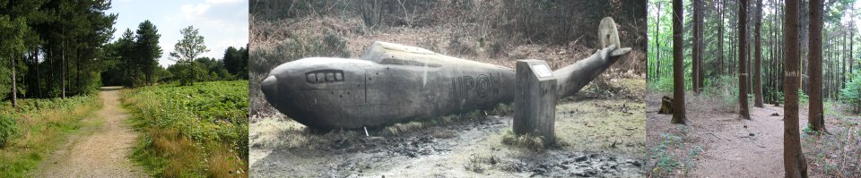
Note wooden sculpture of Hawker Hurricane aircraft
commemorating the crash in 1940 of a plane piloted by
Ian James Muirhead who survived the incident only to be
killed in action two weeks later.
Follow Faesten Dic or red waymarks. Bear right
at dried up pond then take left turn. Cross broad
bridleway, follow section of duckboards and pass pond
with seat on right. At another broad bridleway
take path opposite and follow edge of wood (golf course
on your right) to corner of golf course. Take path
on right and follow, keeping right at every junction,
until it brings you back to the gate at which you
entered the wood. Go through the gate and down the
track to Summerhouse Drive.
|
Points of Interest
Geology
Much of the ground underlying the wood, especially
the higher ground, is very pebbly – these are the
Blackheath Beds of sand and gravel. There are also
Woolwich Beds of clays and sands and, mainly in the
lower parts, Thanet bed of sands. These are
collectively known as the Palaeocene which lies above
the chalk of the North Downs and below the London Clay
that is found further east. In places there are
hollows in the ground known as deneholes – here people
have dug through the sands, gravels and clays to extract
the chalk below to make the soils less acid and perhaps
also to obtain flints found in the chalk.
Faesten Dic
A defensive earthwork built in Saxon times running
for about a kilometre through the wood. “Faesten”
means fortress and “dic” means dyke.

Original profile of the ditch
Public Transport
Buses 429 from Dartford and Swanley (infrequently at
weekends) and B12 from Bexley, Bexleyheath and Erith
serve the stop or the one on the other side of the road
140 metres to the north. Depending on service,
buses to Bexley can be from either stop.
In addition to the walking routes on our web site we
have published three popular walking guides:

Guide to Tunbridge
Wells Circular Walk and other walks in the area

Guide to the
Kent Coast Path: Part 1, Camber to Ramsgate

Guide to Three
River Valley Walks in West Kent: Darent Valley Path,
Eden Valley Walk and Medway Valley Walk
Please report any problems with this walk to
info@kentramblers.org.uk.
Ramblers' volunteers in Kent work tirelessly to
ensure that our paths are as well protected and
maintained as possible. Of course we also organise
led walks but most of our members are independent
walkers who simply want to support our footpath work.
Please
join us and become a supporter too. You need
us and we really need you.
Map contains Ordnance Survey data © Crown copyright
and database rights 2020. Some paths on map are based
on data provided by Kent County Council but do not
constitute legal evidence of the line of a right of way |