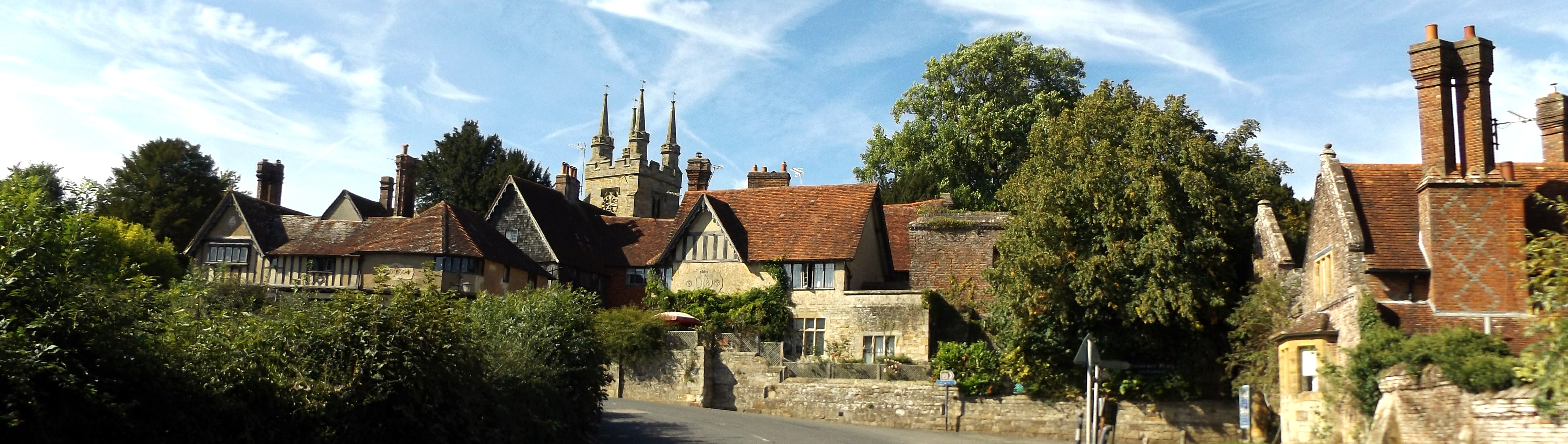
Penshurst and
Bidborough
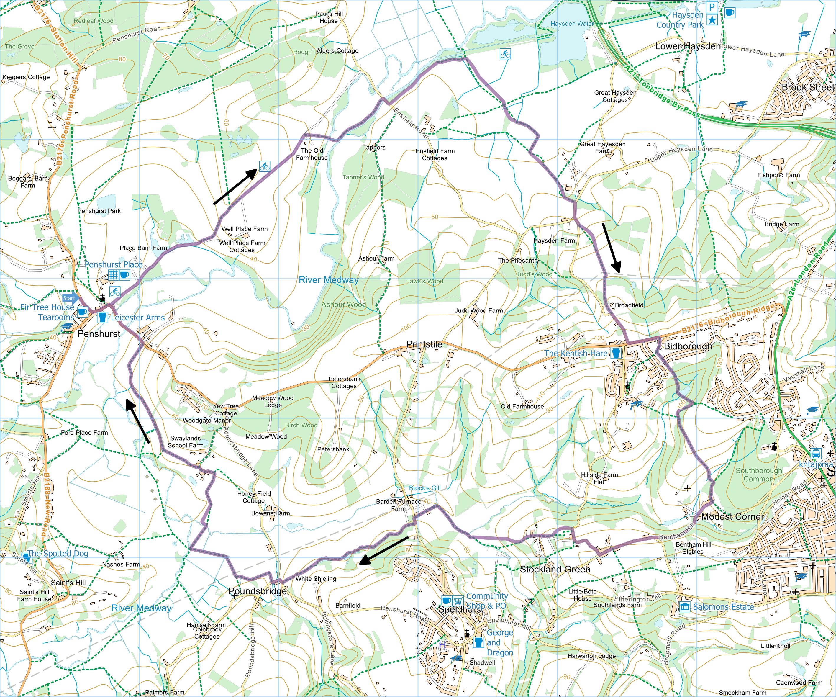
Distance: 9.3 Miles (4h 30m)
OS Map: Explorer 147 (Start at grid
reference TQ535438)
Click map to enlarge and click
again to enlarge further
There is space for parking at the side of Penshurst
Road just north of Latymers.
Go down to road junction and turn left towards
entrance to Penshurst Place. Go through gateway
and along drive past car park and fishing lakes on left.
Soon after lakes, take path on left through gate, along
field edge, through another gate and then bear left
uphill getting fine views looking back at Penshurst
Place. At top go through stile onto path that soon
joins concrete lane (cycle track). Continue
forward on lane until you reach some houses on right.
Just past houses take track on the right and then gate
on left. Through gate bear right downhill to
bridge. Across bridge go straight forward to tree
by bank of Medway and turn left along river bank to
Ensfield road.
Turn right over Ensfield bridge and take path (cycle
track) immediately on left. Follow track to gate
on right, follow left hand edge field to gate and cross
plank bridge. Turn right along path initially
parallel to hedge but gradually bearing left to stile in
fence. Bear right to bridge over ditch few metres
away then follow right hand side of field into corner
and through gate. Turn left along the field edge
until you reach waymark post in hedge. Turn sharp
right across field to electricity pole in middle.
Turn sharp left towards large oak and go through gate
beside it. (The relationship between the field
boundary and the path has been carefully marked on the
map and is more reliable than the OS map at the time of
writing.) Follow left hand edges of two fields to
Haysden Lane.
Turn right to junction, take left fork and soon take
path on left. (At time of writing you can turn
right and shortly go into field on left then follow
right hand edge of field to start of path. This
avoids most of the walk along the sometimes busy lane
but may not always be available.) Follow path
uphill past left hand edge of copse. Continue
uphill towards pylon and on to corner of wood.
Bear slightly right and keep wood on your left as you
follow field edge to stile in corner. Through
stile, cross field to stile in middle of far side, go
through short section of wood across another field to
Gate Farm Road. Turn left up lane to reach road at
Bidborough. You could make a detour right to the
Kentish Hare for lunch (and if you don’t feel like
walking after lunch you can get bus back to Penshurst –
but there’s only one bus every two hours and none at all
on Sundays).
Otherwise cross the road and turn left. Pass
Woodland Way and take footpath (Wealdway) on right.
When you reach left turn, take it. Cross St
Lawrence Avenue and go through gap by wooden gate into
Birch Wood. Follow track downhill and pass lake on
left. You can take detour round lake if you wish.
Follow track past the lake uphill and at waymark post
turn right. Follow path will through kissing gate
into Brookhurst Field where a couple of seats are good
for resting or lunch.
Keep left along top of field and take path (rejoining
Wealdway) through section of woodland and then into
meadow where wild flowers are impressive in late May.
Bear right to gate at protruding corner of Southborough
Cemetery. Follow cemetery hedge on right down to
steps and cross footbridge. On far side head up to
T-junction and turn right, soon emerging at Modest
Corner.
Turn right down street and at bottom follow path down
across cemetery drive to road (Bentham Hill).
Bear right uphill (beware of traffic), at junction with
Stockland Green Road continue forward and take the first
turn on the right (Frank’s Hollow Road).
Follow lane carefully round left hand bend.
When lane bends right downhill, ignore path up steps on
left. But at next right hand corner, take path
over stile on left. Bear left uphill to top corner
of field and through gate. Follow left hand edge
of field to farmyard. Bear right across farmyard
and over steps by gate. Follow track straight
ahead downhill, cross stream at bottom, bear right and
after sharp left turn pass some houses to Barden Road.
Turn left uphill and after a few metres take track on
right; when track soon bears right, go straight forward
along footpath over stile into field. Follow this
path along top edge of fields with woodland, rich with
bluebells in late April and early May, on left. On
reaching lake over fence on left, go over stile turn
right along bank of lake. Go between a couple of
electricity pylons to gate and path that passes another
small lake. Follow path along top edge of next
field and down to Penshurst Road. Turn right and
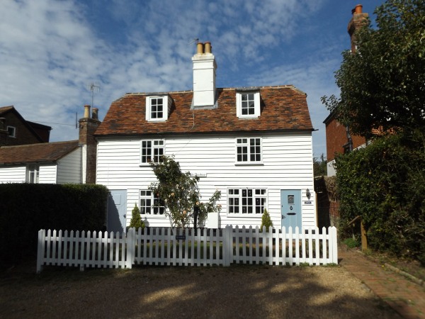
very soon turn left along Poundsbridge Hill past “The
Picture House” bearing date 1593.
Soon take footpath through gate on right. Cross
field, go through a stile and over footbridge.
Turn left along field edge and through gate. Bear
right past large oak to far corner of field. Go
through small gate next to large gate and follow right
hand edge of next field. When fence bears right go
straight ahead and on reaching bridge over Medway don’t
cross it but turn sharp right along path bearing away
from Medway to another bridge. Cross bridge and
turn left along field edge. At corner, turn right
and half way along next field edge take stile on left.
(Strictly path goes diagonally across field from bridge
to stile, but it looks as though everyone follows field
edge.)
Bear right diagonally across field to kissing gate.
Go straight across next field, through two kissing gates
and along left hand edge of field to gate on left.
Through gate keep left at T-junction. Follow drive
past several houses until, having passed Old Swaylands
on left, the drive turns sharp right uphill. Keep
left past front of house on track that becomes grassy
and go through gate into field. Cross the top of
next field to gate and onto broader track all the way to
Rogues Hill in Penshurst. Turn left downhill,
across bridge over Medway and uphill to entrance to
Penshurst Place that you passed near start of walk.
Retrace your steps to your car.
|
Points of Interest
Eden Valley Walk
The first couple of miles of the route follow the
Eden Valley Walk which goes from Cernes Farm west of
Edenbridge to Tonbridge Castle. There is a full
description of the route and the places of interest it
passes in our Guide to Three River Valley Walks.
The Old Farmhouse
Also known as Killick’s Bank, this is a Grade II
listed late mediaeval hall house with alterations, in
particular the probable demolition of one end-bay.
The Kentish Hare
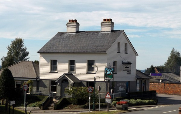
This is a gastropub at Bidborough that has won awards
– not necessarily what a walker with muddy boots and
rucksack is looking for. There is a bar too where
you can get fish and chips or a burger – prices a bit
above average. Not open Mondays and Tuesdays.
Beehive Former Public House
A grade II listed building, probably built as two
cottages in the 18th century. The pub closed in
the 1990s.
Swaylands
The large house up the hill on your right has had a
chequered history. Once popular with the Prince of
Wales (Edward VII) and writers such as J M Barrie and
John Buchan, in 1919 it became the Cassell Hospital for
Functional Nervous Disorders. It later became a
Special School. Around 2012 the buildings were
converted into what at the time appeared to be very posh
apartments but construction defects subsequently emerged
that have require major remedial work, still in progress
at the time of writing.
Public Transport
Buses 231 and 233 from Tunbridge Wells station to
Edenbridge station pass through Penshurst, making the
walk accessible from either station. No service on
Sundays or Bank Holidays.
In addition to the walking routes on our web site we
have published three popular walking guides:

Guide to Tunbridge
Wells Circular Walk and other walks in the area

Guide to the
Kent Coast Path: Part 1, Camber to Ramsgate

Guide to Three
River Valley Walks in West Kent: Darent Valley Path,
Eden Valley Walk and Medway Valley Walk
Please report any problems with this walk to
info@kentramblers.org.uk.
Ramblers' volunteers in Kent work tirelessly to
ensure that our paths are as well protected and
maintained as possible. Of course we also organise
led walks but most of our members are independent
walkers who simply want to support our footpath work.
Please
join us and become a supporter too. You need
us and we really need you.
Map contains Ordnance Survey data © Crown copyright
and database rights 2022. Some paths on map are based
on data provided by Kent County Council but do not
constitute legal evidence of the line of a right of way |