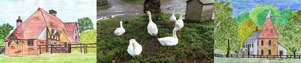
Chiddingstone
Causeway
Distance: 4.3 Miles (2 Hours)
OS Map:
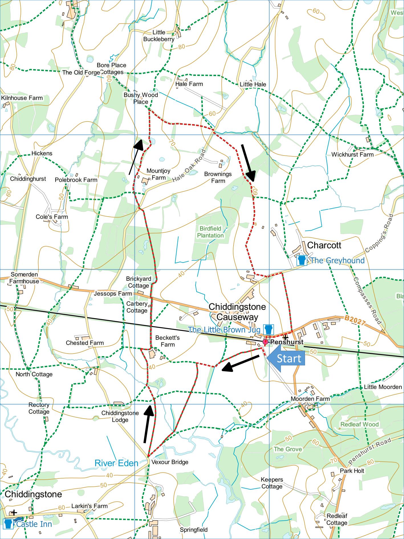
Explorer 147 (Start at grid reference TQ520464)
Click map to magnify and click
again to magnify further
Park in Station Hill on the south side of Penshurst
Station (which is at Chiddingstone Causeway, two miles
from Penshurst). Don’t park in the station yard as that
apparently belongs to the adjacent timber yard who
charge £3 per day.
Go down Station Hill towards station and take path on
left immediately before entrance to timber yard. Follow
right hand edge of one field and cross next field to
hedge. Turn left and follow path round edge of the field
to gate. Go through gate, along left hand edge of field
then over stile by another gate. Soon take stile on left
and follow right hand edge of field. Cross next two
fields towards a footbridge but on approaching it bear
right into the corner of field and cross smaller
footbridge. Bear left to the far corner of field and
gate into the road near Vexour Bridge over river Eden.
Don’t go through gate but almost double back over
field you have just crossed (almost due north) to gap in
hedge and cross another field. Approaching a copse, aim
for gateway at left hand end. Go through gateway across
bridge over stream (it can be muddy here after rain) and
climb towards Beckett’s Farm. Keep well left of farm to
stile. Climb stile and turn sharp right along hedge and
then over another stile into farm lane. Turn left along
lane, over railway and on to main road.
Bear left across road to path through wood. On
emerging from wood, head for highest corner of field and
gate into lane. Bear right across lane to path across
field to corner of hedge around Mountjoy Farm then along
hedge (with farm on your right), through two metal gates
and for a short distance between hedges. Go through gate
on left through copse and into field.
Follow right hand edge of field briefly, then bear
left across field to gate. Through gate, turn right
along path through woodland between hedges and into next
field. Follow left hand edge of this field for a few
metres then bear right across field to gate into lane.
(Sometimes path across field is ploughed up, in which
case you can follow left hand edge of field instead.)
Bear right across lane, cross middle of field then
head for far right corner of next field. Go straight
through narrowest part of wood to far side and bear
right along edge of wood. Bear left across corner of
next field then along left hand edge to corner. Follow
left hand edge of next field and bear left across middle
of another field to stile somewhat to left of an oast
house. Go over stile onto track and turn left to lane.
Turn left along lane and take asphalt footpath on
right down to road at Chiddingstone Causeway. Turn right
past church to Little Brown Jug public house where you
can get refreshments if you are not too muddy.
Cross
road to station and cross footbridge back to car (or
catch train home).
.
|
Points of Interest
Chiddingstone Causeway
The name suggests proximity to a Roman Road which the
nearby settlement named Camp Hill may support.

The
village was for two centuries synonymous with the
production of quality cricket bats and balls by the Duke
family.
About three-quarters of the way along the asphalt
path near the end of the walk you pass an old concrete
air raid shelter on the right. This is a relic of
a World War II airfield that once occupied this land.
Another relic is the pill box in the field on the left.
In addition to the walking routes on our web site we
have published three popular walking guides:

Guide to Tunbridge
Wells Circular Walk and other walks in the area

Guide to the
Kent Coast Path: Part 1, Camber to Ramsgate

Guide to Three
River Valley Walks in West Kent: Darent Valley Path,
Eden Valley Walk and Medway Valley Walk
Please report any problems with this walk to
info@kentramblers.org.uk.
Ramblers' volunteers in Kent work tirelessly to
ensure that our paths are as well protected and
maintained as possible. Of course we also organise
led walks but most of our members are independent
walkers who simply want to support our footpath work.
Please
join us and become a supporter too. You need
us and we really need you.
Map contains Ordnance Survey data © Crown copyright
and database rights 2020. Some paths on map are based
on data provided by Kent County Council but do not
constitute legal evidence of the line of a right of way |