Chartwell and Toy's Hill
Distance: 5.5 Miles (2.5 Hours)
OS Map:
Explorer 147 (Start at grid reference TQ455517)
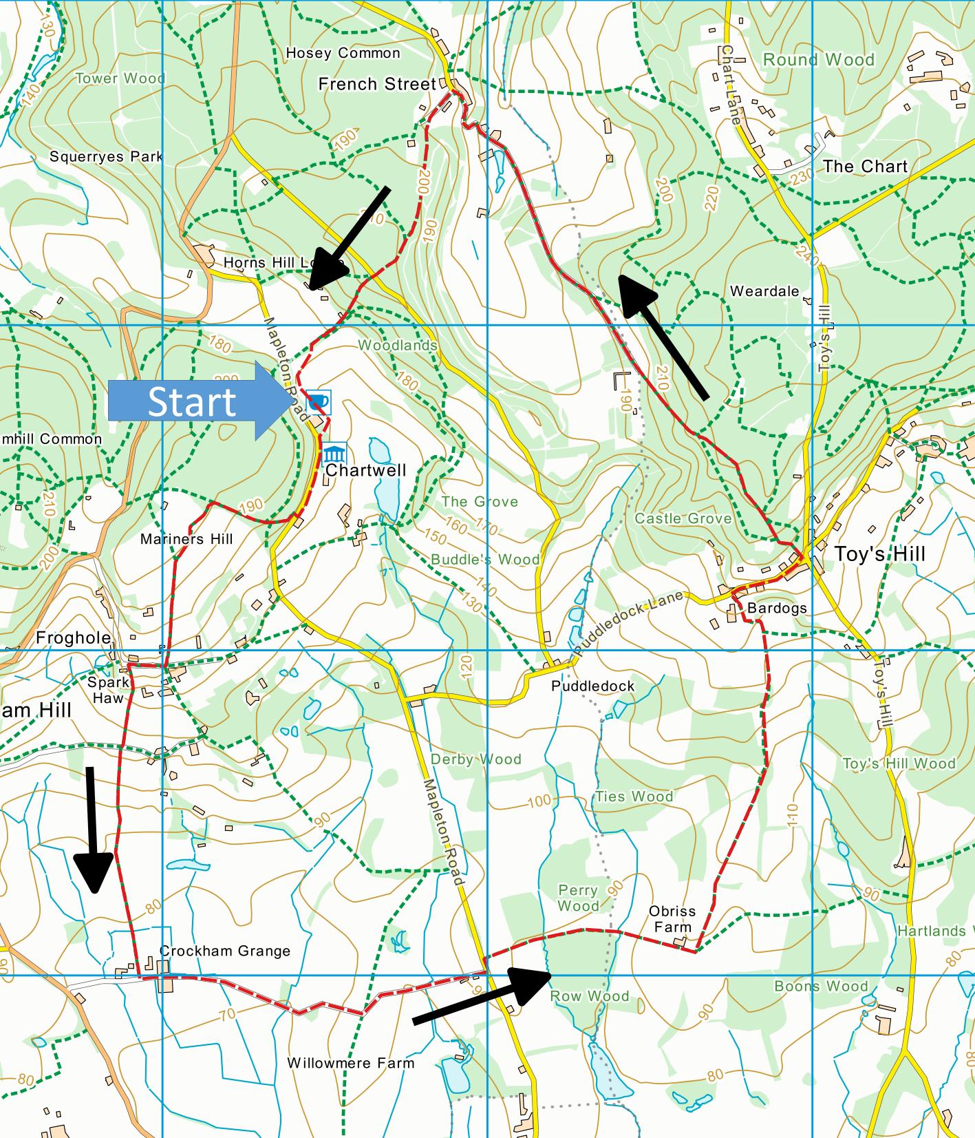
Click map to enlarge and click
again to enlarge further
Park in National Trust car park at Chartwell – free
for NT members and £4 for others – open every day except
Christmas Day and Boxing Day from 9am until 5.30pm or
dusk if earlier.
Leave car park by exit (past restaurant, shops and
toilets) and turn left along Mapleton Road past
Chartwell house. When wall on the left ends, just
past lay-by, take bridleway uphill through woods.
When path levels out somewhat, take left turn,
waymarked “National Trust Limpsfield Walk”.
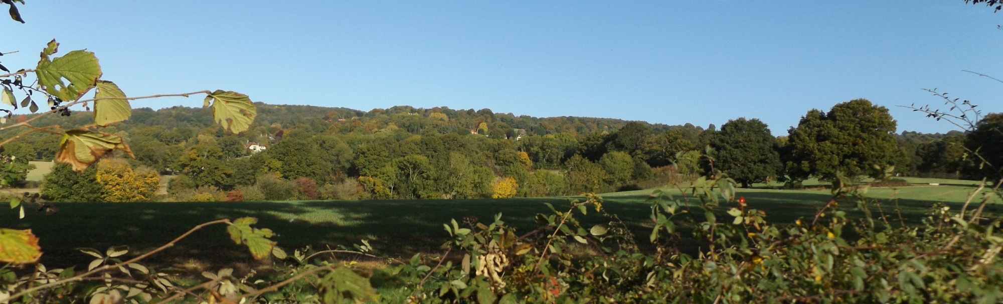
Continue alongside Mariners Hill, with magnificent views
across Bough Beech Reservoir towards The Weald.
After some steps, keep left, leaving Limpsfield Walk.
Follow path downhill until you reach Froghole Lane.
Turn right.
When lane turns sharp right, turn sharp left down
path immediately before house called Spark Haw (not path
immediately beyond, signposted “Crockham Hill Church”).
Go downhill between fences, across duckboards then down
left hand edge of field to asphalt track.
Bear right to path through gate just across track.
Cross middle of one field, follow edge of another and
then start to follow edge of a third. When hedge
on left field turns sharp left, carry straight on across
field to gate by oak tree soon followed by another gate.
Cross right hand edge of paddock and go through third
gate to reach farm track.
Turn left along track through Grange Farm and follow
for just over half a mile to Mapleton Road. Turn
left and take first track on right through gate.
Follow track past Obriss Farm and through gate.
Turn sharp left and walk along left hand edge of field.
Cross next field diagonally right, going over highest
point of field to far corner, then along next field
edge. Go through short section of wood, then
steeply uphill enter more woodland and along track
between hedges. Continue round sharp left hand
bend, steep section and then sharp right hand turn (gate
straight ahead leads to private house (Bardogs), but
path on right is not obvious until you get right up to
gate). Follow path up to Puddledock Lane and turn
right uphill. Pass seat and view point by Octavia
Hill’s Well on right where you can stop to rest and
admire fine views across The Weald.
Continue along lane to centre of Toy’s Hill village.
Just past red telephone box on left take path going
quite steeply uphill. Follow path, bearing right
and climbing steeply at first junction. Carry
straight on or bear slightly left at all later
junctions, soon joining Greensand Way and following blue
waymarks. Path first climbs and then descends,
emerging from wood along level track to meet lane coming
down from right. Follow lane downhill to valley
bottom, then uphill through French Street. In
middle of French Street, turn left along drive (tarred
initially), well signposted with various waymarks
including one for Greensand Way. Bear left when
hedge does and follow Greensand Way markers until you
reach Hosey Common Lane.
Cross lane and take left of two paths downhill and
back to Chartwell car park.
The tearoom is normally open from 10 to 5 (not
Christmas Day or Boxing Day).
|
Points of Interest
Crockham Grange Cart Shed and Granary
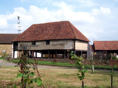
This Grade II listed building is timber-framed with
an open cart shed on the ground floor and a granary
above with queen post roof and whitewashed wattle and
daub walls.
Octavia Hill’s Well
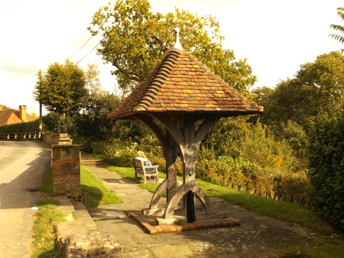
The well with views of Bough Beech reservoir (Walk
18) and Ashdown Forest was one of the National
Trust’s first properties, given by Octavia Hill, one of
the Trust’s founders, who lived and is buried at
Crockham Hill (Walk 14).
Public Transport
On summer Sundays and Bank Holidays there is a bus
service, route 246, from Bromley via Westerham.
In addition to the walking routes on our web site we
have published three popular walking guides:

Guide to Tunbridge
Wells Circular Walk and other walks in the area

Guide to the
Kent Coast Path: Part 1, Camber to Ramsgate

Guide to Three
River Valley Walks in West Kent: Darent Valley Path,
Eden Valley Walk and Medway Valley Walk
Please report any problems with this walk to
info@kentramblers.org.uk.
Ramblers' volunteers in Kent work tirelessly to
ensure that our paths are as well protected and
maintained as possible. Of course we also organise
led walks but most of our members are independent
walkers who simply want to support our footpath work.
Please
join us and become a supporter too. You need
us and we really need you.
Map contains Ordnance Survey data © Crown copyright
and database rights 2022. Some paths on map are based
on data provided by Kent County Council but do not
constitute legal evidence of the line of a right of way |