Cudham, Luxted &
Berry's Green
Distance:
3.9 Miles (1.75 Hours)
OS Map:
Explorer 147 (Start at grid reference TQ446597)
Click map to magnify and click
again to magnify further
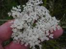
Park in car park at Cudham recreation ground (on
left, just past Blacksmith’s Arms, when approaching from
Green Street Green). No charge. Closing
times vary from as early as 4.30pm in December to 8.30pm
in May.
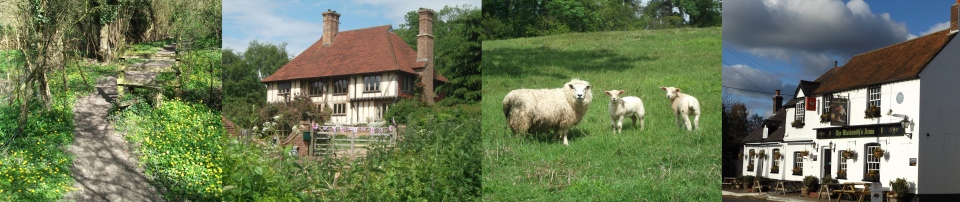
Leave car park at north end (by the noticeboard) on
asphalt path past tennis court and toilets. On
reaching churchyard, follow path round to left, past
church and into Church Approach. Descend to Cudham
Lane and cross carefully into Church Hill. Bear
left at junction but almost immediately take footpath on
right. Do not take the path going forward but turn
sharp left down steps (waymarked Berrys Green Circular
Walk/Cudham Circular Walk) then through gate and down
hill on right hand side of field. Carry straight
on down to valley bottom and up the other side into
wood. Climb through wood and between fences to
Single Street.
Cross road and take path between houses to field.
Turn sharp right and follow path along top edges of
fields, soon between fences, to road at Luxted.
Turn left and follow road carefully. When road
soon bears right, keep left down Birdhouse Lane.
Follow lane downhill, up other side and through former
Scout Activity Centre. Go through gap to left of
white metal gate marked “No Vehicles”; soon track
becomes a path between hedges. Emerge into fields
and follow left hand edges to Jail Lane. Turn
right (taking care and using left hand side of road for
maximum visibility) until footpath sign on left (to
Biggin Hill ¾m).
Take path along edge of field, past copse on left and
over stile. Continue along right hand edge of
field for short distance to another stile. Do not
cross this stile but turn left uphill with fence on your
right and follow waymarks, ignoring a right turn, until
you reach the asphalt drives to Foal Farm and golf club.
Cross drives carefully onto golf course and follow
yellow waymarks across golf course towards stile just
left of copse (once over bund aim right of house ahead).
After leaving golf course follow path between fences to
road at Berry’s Green.
Go straight across into Restavon Park, an estate of
prefabricated homes. Follow drive downhill and
soon after it bends to left take signposted path on
right between homes into wood.Take first left along
broad track. Nearing lane, bear right along
permissive path between fences. After path starts
to climb, take left fork steeply up to stile, cross and
continue to climb steeply to seat with fine views across
valley. After admiring the view continue upwards
to join Cudham Lane opposite Blacksmith’s Arms.
Turn right and shortly reach car park
|
Points of Interest
Wildflower Meadow
This section of the walk passes through grassland
created from formerly arable fields. It is used to
grow hay rich in local species to create grassland
typical of the North Downs such as the common knapweed
and wild carrot, below.
The purplish-red flowers at the centre of the wild
carrot floret were considered by the herbalist Nicholas
Culpeper to be an aid to conception when boiled in wine
and drunk.
Downe Camp
The 66 acre site was bought by founder of the Scouts,
Lord Baden-Powell, in 1929 to train leaders. From
1933 it was used as an adventure camp for Scouts.
In 2020 the site was put up for sale by the Scouts to
help solve a financial crisis resulting from the
Covid-19 pandemic.
In addition to the walking routes on our web site we
have published three popular walking guides:

Guide to Tunbridge
Wells Circular Walk and other walks in the area

Guide to the
Kent Coast Path: Part 1, Camber to Ramsgate

Guide to Three
River Valley Walks in West Kent: Darent Valley Path,
Eden Valley Walk and Medway Valley Walk
Please report any problems with this walk to
info@kentramblers.org.uk.
Ramblers' volunteers in Kent work tirelessly to
ensure that our paths are as well protected and
maintained as possible. Of course we also organise
led walks but most of our members are independent
walkers who simply want to support our footpath work.
Please
join us and become a supporter too. You need
us and we really need you.
Map contains Ordnance Survey data © Crown copyright
and database rights 2020. Some paths on map are based
on data provided by Kent County Council but do not
constitute legal evidence of the line of a right of way |