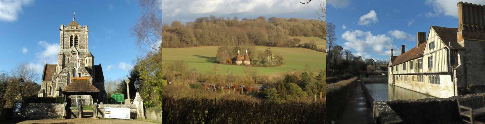
Ightham Mote, Fairlawne
Estate & Underriver
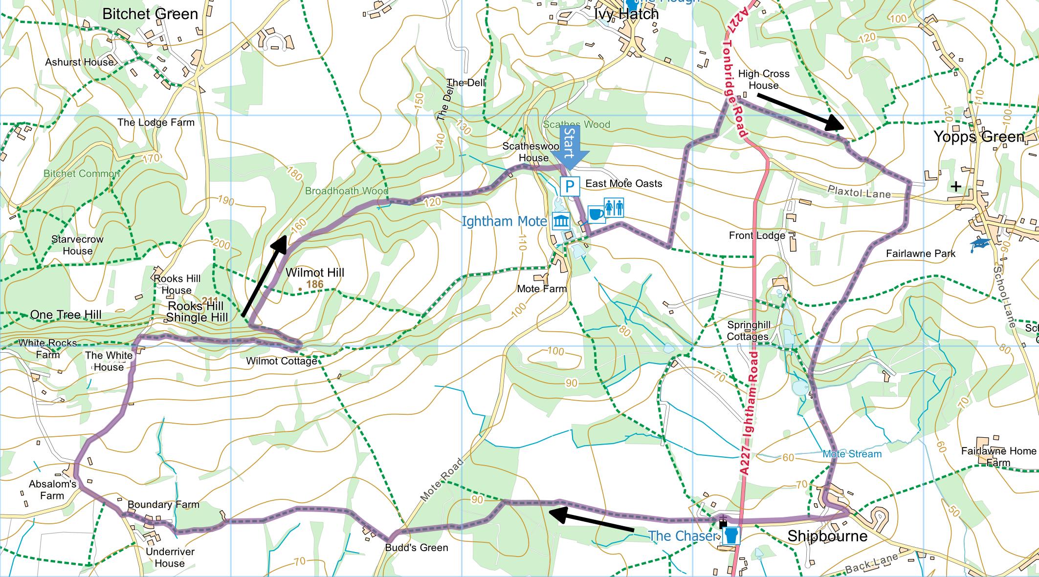
Distance: 6.8 Miles (3h 45m)
OS Map: Explorer 147 (Start at grid reference TQ584536)
Click map to enlarge and click
again to enlarge further
Park in National Trust car park at Ightham Mote –
open all year, dawn to dusk, whether or not house is
open. No charge for members (£3 for non-members at
time of writing). There are toilets, but these are
only open when house and restaurant open.
Go past or through walled garden and leave staff car
park at bottom past restaurant and toilets. Turn
left along path waymarked with red arrows. At
first junction follow red arrows left uphill along left
hand edge of field. At top enter wood; red arrows
go left but our route goes right. Follow up path
through wood to emerge through gate onto road (A227).
Bear right and cross road to track opposite through
gate. Follow track through trees and into open
field. Continue along right hand edge of field to
track and turn right downhill through gate to Plaxtol
Lane.
Take footpath opposite and go straight across field
past fenced avenue of trees on right and bear right to
yellow post. Bear right to another yellow post by
stile. Over stile, maintain direction past another
yellow post, noting view of Fairlawne house on right.
Bear left to corner of field and take gate through fence
into Fairlawne gardens. Go down to driveway and
bear left, taking lower of two branches of drive.
Pass lake on right and go through gate into field.
Follow left hand edge of field until fence turns left,
when bear slightly right over footbridge. Go
straight across next field, between houses at top and
through gap to right of first house. Follow lane
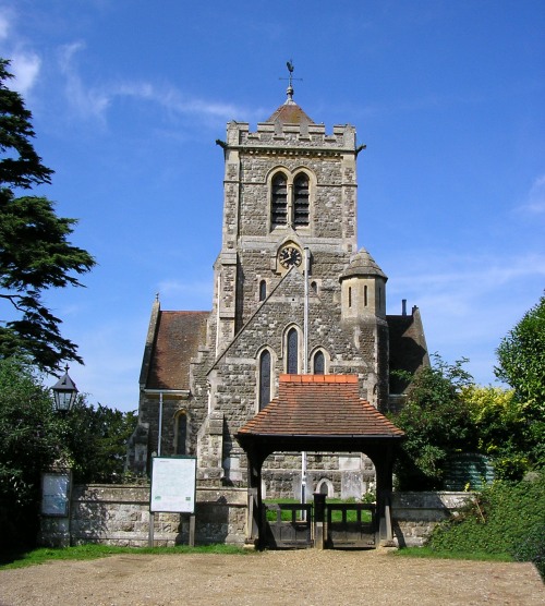
forward into Shipbourne (pronounced “Shibbun”).
Turn right along Upper Green Road, making for church.
Cross A227 and go through churchyard. Leave by
kissing gate at far side and go down right hand edge of
a field. Go straight across next field, making for
corner of woodland protruding into it. At corner,
enter woodland and bear right along broad track,
climbing gradually. After 300m at junction of
paths take second left uphill and just beyond top bear
right along broad track leading down to stile Mote Road.
Turn left but immediately bear right across green
towards driveway. Take path between fence and
hedge to right of Great Budds. After climbing
stile into field, go straight across. When gravel
track turns left on entering next field, carry straight
on across the field to footbridge and stile into next
field. Cross another field, making for some large
barns. Go through gates/stiles to left of barns
and climb along right hand edge of field to corner,
climb stile and bear alongside fence towards wooden
gate. Just before gate, turn sharp left along
driveway. At junction of drives, bear right onto
driveway and follow it down to Underriver House Road.
Turn right and then right again into Rooks Hill just
in front of Absalom’s Farm. Climb Rooks Hill
until you reach woodland and public footpath sign on
left. Carry on a few more metres to public footpath
sign on right and go through gate. Follow path
initially between two fences but later in woodland.
At junction of paths by information board, turn left
along path climbing steeply, passing steps and bearing
left to double back on previous route. Pass seats
offering fine views across the Weald. On leaving
National Trust property past barrier, turn right along
permissive path. On reaching bridleway, go
straight across past another barrier and follow
permissive path along bottom of open glade.
Continue through woodland and, on meeting broader track
at corner, go straight ahead along it. On reaching
Mote Road, take path opposite back into Ightham Mote
estate. On reaching drive at top, turn right into
car park.
In addition to the walking routes on our web site we
have published three popular walking guides:

Guide to Tunbridge
Wells Circular Walk and other walks in the area

Guide to the
Kent Coast Path: Part 1, Camber to Ramsgate

Guide to Three
River Valley Walks in West Kent: Darent Valley Path,
Eden Valley Walk and Medway Valley Walk
|
Points of Interest
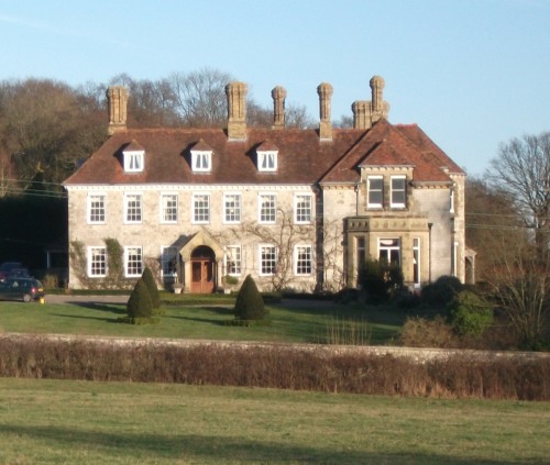
Fairlawne Estate
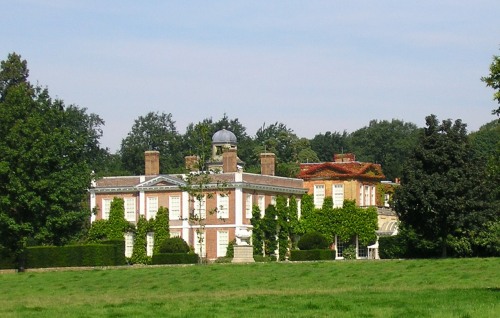
The original moated manor on the site was called Fair
Lane and belonged in the 17th century to Sir Henry Vane
the Younger. He supported Parliament against
Charles I in the Civil War, but opposed the King's
execution and fell out of favour with Cromwell.
Despite this, on the restoration of the monarchy,
Charles II thought Vane’s views on democratic reform
dangerous and had him sentenced to death on a charge of
treason. Samuel Pepys, who watched the execution
on Tower Hill in June 1662, recorded that Vane "appeared
the most resolved man that ever died in that manner, and
showed more of heat than cowardize, but yet with
humility and gravity". Vane is buried in
Shipbourne church.
In the 20th century the estate was owned by Sir Peter
Cazalet who trained horses owned by the Queen Mother who
was a regular overnight visitor. The current owner
is Prince Khalid Abdullah of Saudi Arabia.
In 2011 the Prince attempted to close a public
footpath across the estate but local residents rebelled
and, supported by local Ramblers, won an appeal to the
Planning Inspectorate to keep it open.
The present house was built in the early 18th
century.
Underriver House
The Queen Anne house was built in 1697 for Richard
Goodhugh. In 1790 the house was bought by the
Woodgate family of nearby Riverhill House and by 1840 it
was let to Charles Townsend who was visited by Samuel
Palmer, a renowned landscape artist who from 1826 to
1835 was based at nearby Shoreham. Palmer called
the area around Underriver his “Golden Valley”,
featuring in several of his paintings. In 1976
music producer John Coletta bought the house where he
entertained celebrity guests such as his friend Charlie
Drake. The house has since changed hands at least
twice.
Stables at Absalom’s Farm
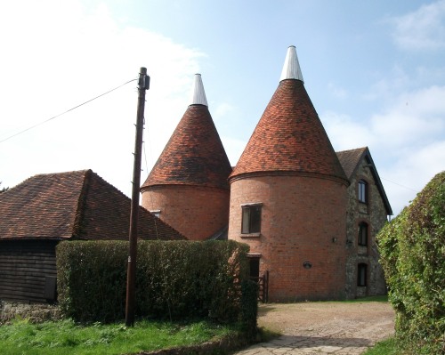
This Grade II listed building is on your left as you
begin your ascent of Rooks Hill. Low stone walls
are topped by a brick layer, black weatherboarding and a
hipped, tiled roof. It is part of a group of
listed buildings including a pair of oast houses, the
farmhouse, a granary, a cowshed and a cobbled courtyard
on the other side of the stables.
Public Transport
Start and finish the walk at Shipbourne and get a bus
from Tonbridge or Borough Green.
Please report any problems with this walk to
info@kentramblers.org.uk.
Ramblers' volunteers in Kent work tirelessly to
ensure that our paths are as well protected and
maintained as possible. Of course we also organise
led walks but most of our members are independent
walkers who simply want to support our footpath work.
Please
join us and become a supporter too. You need
us and we really need you.
Map contains Ordnance Survey data © Crown copyright
and database rights 2022. Some paths on map are based
on data provided by Kent County Council but do not
constitute legal evidence of the line of a right of way |