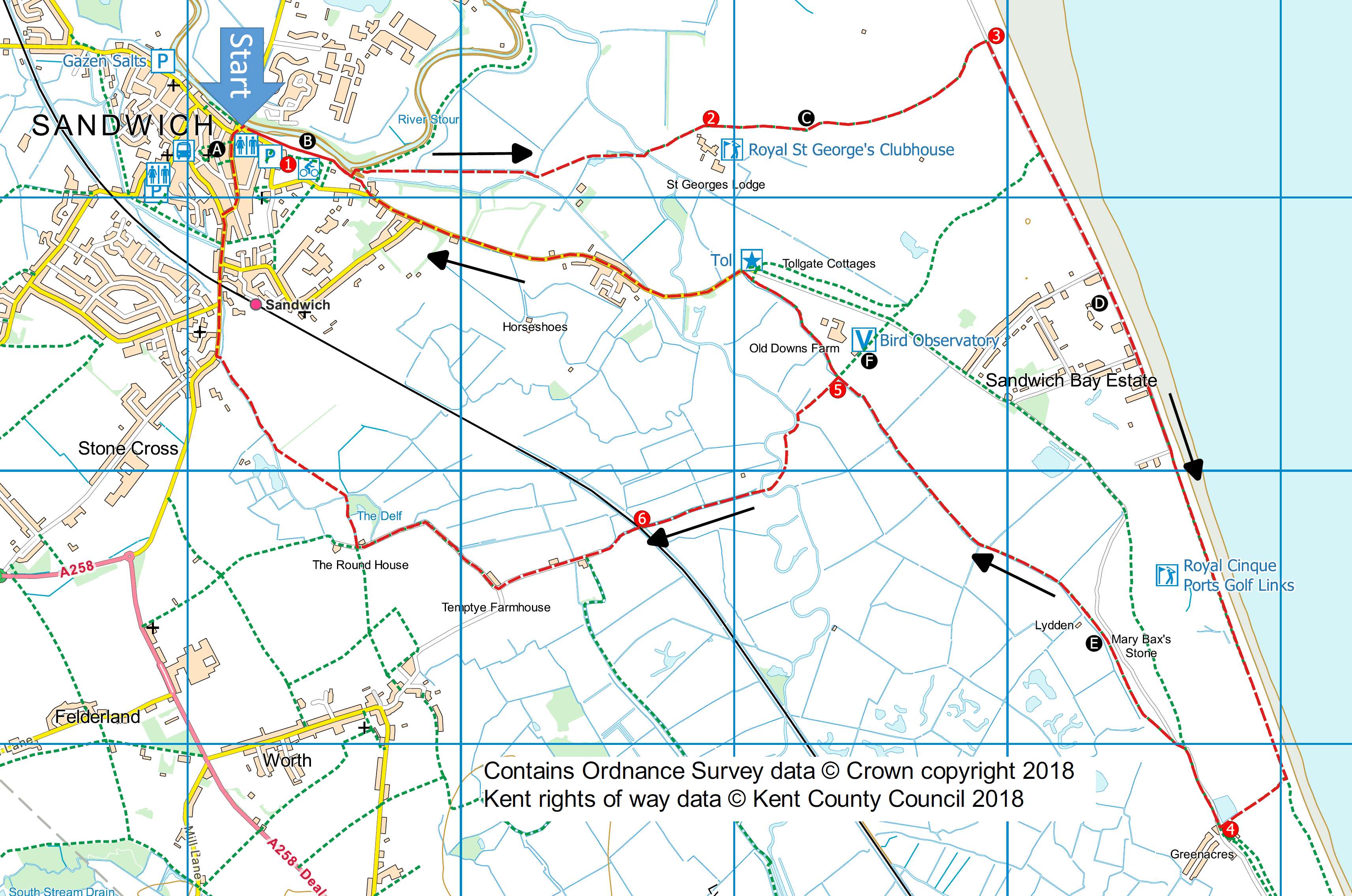
Sandwich and the Sea
Distance: 8.4 miles (3.5 hours) or
6.9 miles (3 hours) if short cut taken
OS Map: Explorer 150 (Start
at grid reference TR 334582)
Click map to magnify and click
again to magnify further
Start from the Quayside car park. You could
park here but there is a hefty charge every day
including Sunday – £1 an hour or £6 for a full day.
The Guildhall and Gazen Salts car parks are free on
Sundays and the latter is only 70p an hour or £4 a day
on other days at the time of writing.
1. Follow the broad tarmac path in an easterly
direction away from the quayside. In 300yds turn L
across a metal footbridge and turn R. When the
path divides take the R fork and follow for half mile to
cross another metal bridge, keeping to the SSW.
Continue on for 150yds and cross a farm road.
APPROX 1mile.
2. Now enter Royal Saint Georges Golf Links.
The path across the course is excellently way-marked
with a succession of sign stones, white posts and
notices: ‘To the Sea’. In ¾ mile you reach a road,
Princes Drive, which runs alongside the beach. APPROX 1¾
miles.
3. Pass through the kissing gate, then turn R and
follow the road for ¾ mile to Sandwich Bay Estate (you
can walk on the beach if preferred). At the end of
the Estate, by the Sailing Club, pass through a kissing
gate onto a stony track (still adjacent to the sea) and
follow for a further ¾ mile. You are now walking
alongside ‘Royal Cinque Ports Golf Club’. After
passing an oil drum painted red and white, take first
path on R across the course and in 200yds emerge onto
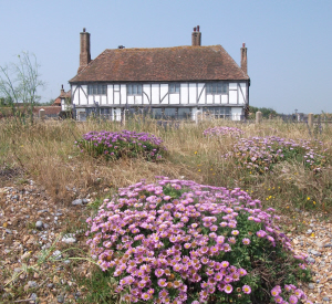
the road by the former Chequers pub, now a cookery
school. APPROX 4 miles.
4. Turn R and stay on the road for ¼ mile until you
reach two finger posts. Bear left along the
asphalt road and shortly bear left up a bank towards
some metal gates. Do not go through the gates but
turn right along a bank. Follow the bank, which
can be a bit overgrown in midsummer, past Mary Bax Stone
(don’t blink or you’ll miss it, just a few feet below
the path on your R) and the bungalow on your L. Shortly
after the bungalow, bear L down the bank to a stile and
follow the path along the edge of a series of fields
passing through several kissing gate until you reach a
dirt road. The Bird Observatory is a short distance to
the R.
5. You now have two options:
For the SHORTER WALK go straight across the road and
pass through the first of several kissing gates
(installed by the stiles team of White Cliffs Ramblers)
until you reach a road at a toll house. Turn L and
follow the road into Sandwich. Soon after passing
St George’s Road on the L, there is a path on the R
taking you back to the quayside.
However, you could instead carry on until you reach
the town walls where you can turn L along a very
attractive path (marked green on the map) following the
walls right round the town to Strand Street. Here
turn R and continue back to the quayside.
For the LONGER WALK turn L onto the Bridleway.
It briefly follows a stream, then crosses a concrete
bridge (to which a footpath which diverts R from the
Bridleway will also take you) and goes between hawthorn
bushes and brambles until in just over ½ mile you reach
a level crossing.
APPROX 6 miles
6 Keep straight on. The path soon becomes a
metalled road; follow until it bends sharply to the L at
Temptye farmhouse. Here you turn R, indicated by a
Bridleway Finger Post, still on a metalled road, and in
just under ½ mile turn R again by an attractive white
house. Follow the tarmac path which crosses a
metal bridge until you reach a main road. APPROX
7¼ miles.
Turn R and continue on, over the level crossing and
turn R again at Mill Wall. Follow back to the
Quay.
This walk was originally published on a calendar
produced by White Cliffs Group. Thanks to Ted
Roche for originally devising this route, Diana
Blackwell for checking the directions and Andrew
Boultbee for the idea. Robert Peel has updated the
directions and provided the photographs.
If you find that the directions and map for this walk
are incorrect in any way, please report the problem to
info@kentramblers.org.uk.
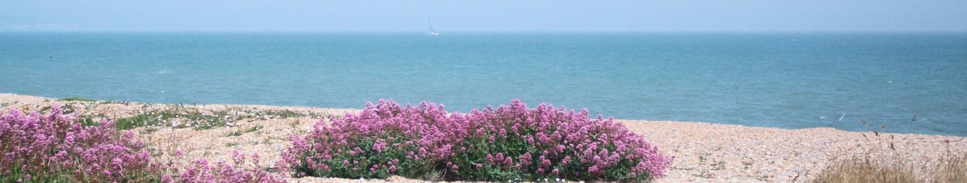
Sandwich Bay - Isle of Thanet on
the horizon
|
Points of Interest
A.
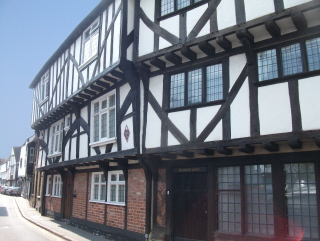
Sandwich is considered to be one of the
most complete medieval towns in England. It has changed
relatively little over the centuries and its buildings,
streets and alleyways still provide the visitor with
much to explore. A ‘walled town’, it can still be viewed
by walking round parts of the original ramparts.
B. The Quay was in the 13th century
an important harbour for the export of wool. Lying in
the ‘Wantsum channel’, it could accommodate many
hundreds of vessels but in the 14th century it began
silting up and by the 16th century was some 2 miles from
the sea. It became, as now, merely an arm of the river
Stour.
C. Royal Saint Georges Golf Links,
founded 1887, is perhaps the most famous of three
championship golf courses situated here. ‘Princes’, to
the north, founded in 1912, hosted the Open Championship
in 1932 and ‘Royal Cinque Ports’ to the south, founded
in 1892, often holds the Amateur Championships. Royal
Saint Georges has hosted the British Open on ten
occasions.
D. Sandwich Bay Estate consists of a
number of large houses which although in many cases look
very old are, in fact, part of a development begun in
1912. They are the product of several well known
architects of the time and the resulting variety of
styles provides for an interesting detour.
E. Mary Bax stone marks the spot
where Mary Bax, a local girl was murdered by a foreign
gentleman on August 25th 1782.
F.
Sandwich Bay
Bird Observatory (just a few yards off the
route) has been recording aspects of wildlife and, in
particular the ringing of birds since 1952. It is an
important station for monitoring bird migration.
Visitors welcome. Open 10am-4pm 7 days per week.
In addition to the walking routes on our web site we
have published two popular walking guides:

Guide to the
Kent Coast Path: Part 1, Camber to Ramsgate

Guide to Three
River Valley Walks in West Kent: Darent Valley Path,
Eden Valley Walk and Medway Valley Walk
Ramblers' volunteers in Kent work tirelessly to
ensure that our paths are as well protected and
maintained as possible. Of course we also organise
led walks but most of our members are independent
walkers who simply want to support our footpath work.
Please
join us and become a supporter too. You need
us and we really need you.
Map contains Ordnance Survey data © Crown copyright
and database rights 2018. Some paths on map are based
on data provided by Kent County Council but do not
constitute legal evidence of the line of a right of way
|