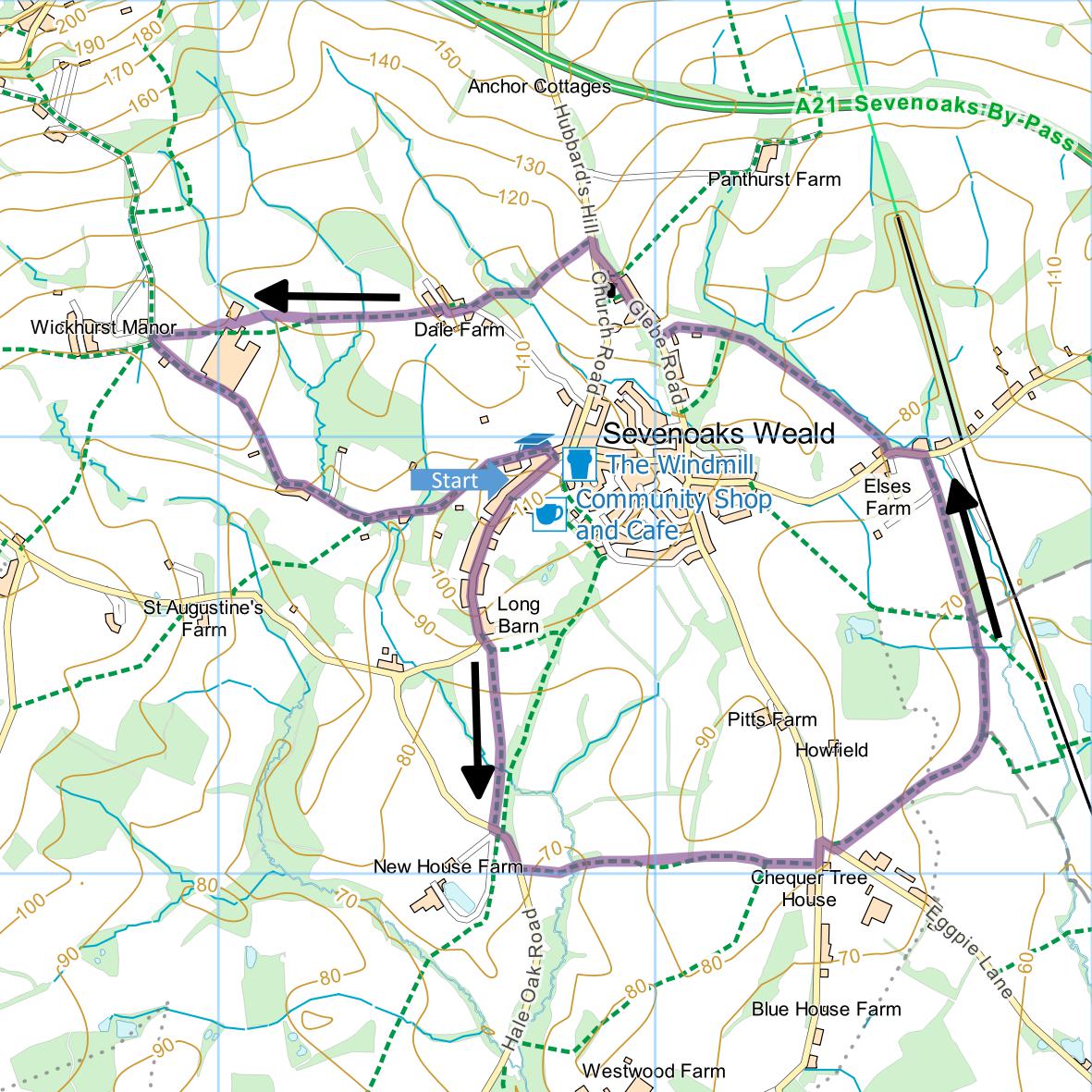
Sevenoaks Weald and Elses
Farm
Distance: 4.0 Miles (1h 50m)
OS Map: Explorer 147 (Start at grid reference
TQ527508)
Click map to enlarge and click
again to enlarge further
Park in Sevenoaks Weald. There is usually room
to park on the road alongside the village green near the
school. The village is easily approached from the
A21 – drive straight through the village to reach the
village green on the other side.
From the school head uphill along Long Barn Road.
Beyond highest point descend gently and at sharp right
hand bend bear left onto footpath across field passing
two large oak trees. At far side, bear right,
cross a footbridge and continue along field edge to Hale
Oak Road.
Turn left and after 100 metres take footpath on left
(SR282) through chain gate by oak tree. Go
straight across field, cross a footbridge and climb some
steps. Go uphill across next field and through two
gates at top. Follow left hand edge of next two
fields to reach the lane.
Turn left then right into Eggpie Lane. After 40
metres take footpath through gate on left and go
straight down long field, passing stile half way along
and eventually bearing slightly left to far corner.
Go through gate and turn right along curving edge of
field, ignoring path going off on right, to gateway in
corner. Follow right hand edges of next field and
go straight across field after that. Follow grassy
track with fence on left and woodland on right.
Join stony track and follow down to road.
Turn left past Giacomo’s Italian restaurant on right.
When road bends left opposite Elses Farm, take footpath
long track on right. Continue past
cricket/football field at a stile bear left. At
fork in path bear right uphill and continue, passing to
left of burial ground, to Glebe Road.
Turn right and take path on left just before church.
On reaching Church Road, turn right and take path on
left at junction just past bus shelter.
Follow left hand edge of field downhill to footbridge
over stream at bottom. Cross and bear right uphill
making for the oast house at the top. In top
corner of field next to oast house, go over stile and
turn right along drive. Past oast house turn right
then almost immediately left between farm buildings and
through gate. Bear slightly right downhill across
field to gate, cross stream and cross next field to
gate. Bear right across next field to gate in corner.
Bear right uphill between farm buildings, go over
through gate and bear left across a couple more fields
into lane by Wickhurst Manor.
Turn left and follow Wickhurst Road (really just a
farm track) back to Sevenoaks Weald. Turn right
along road to return to school.
|
Points of Interest
Long Barn
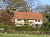
– the home of Vita Sackville-West and Harold
Nicholson before their move to Sissinghurst (see
Walk 85).
Elses Farm

From 1904 to 1906 the home of the poet Edward Thomas
(1878-1917). The farm featured in his book The
Heart of England. Thomas was killed in action at
the Battle of Arras.
Public Transport
There are buses to Sevenoaks Weald from Sevenoaks,
Tonbridge and Tunbridge Wells. They are not
frequent so check
www.traveline.info for more details.
In addition to the walking routes on our web site we
have published three popular walking guides:

Guide to Tunbridge
Wells Circular Walk and other walks in the area

Guide to the
Kent Coast Path: Part 1, Camber to Ramsgate

Guide to Three
River Valley Walks in West Kent: Darent Valley Path,
Eden Valley Walk and Medway Valley Walk
Please report any problems with this walk to
info@kentramblers.org.uk.
Ramblers' volunteers in Kent work tirelessly to
ensure that our paths are as well protected and
maintained as possible. Of course we also organise
led walks but most of our members are independent
walkers who simply want to support our footpath work.
Please
join us and become a supporter too. You need
us and we really need you.
Map contains Ordnance Survey data © Crown copyright
and database rights 2022. Some paths on map are based
on data provided by Kent County Council but do not
constitute legal evidence of the line of a right of way |