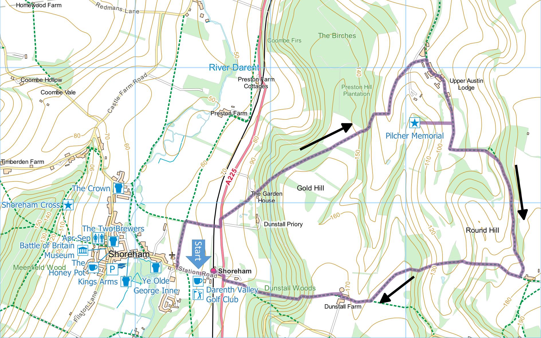
Shoreham Station and
Upper Austin Lodge
This walk passes through the delightfully quiet and
beautiful Austin Lodge Valley. However, there are
a couple of stiff climbs.
Distance: 4.7 Miles (2 hours)
OS Map: Explorer 147 (Start at grid
reference TQ526615)
Click map to enlarge and click
again to enlarge further
Park in the vicinity of Shoreham station. There
is a lay-by immediately opposite the station or you can
park in Station Road.
Proceed down Station Road away from station and take
path (Darent Valley Path) on right opposite entrance to
Shoreham Place. Cross bottom of field with wall
then hedge on left. When hedge ends, turn right
along far side of hedge to railway, cross with care and
continue to road.
Cross road and turn left, keeping as far onto narrow
verge as you can. Very shortly take path through
gap in hedge on right leading into field. Bear
left across field making for gap in hedge on far side.
Follow track through wood and out at bottom of a garden.
Cross garden diagonally uphill between fences, cross
drive and take path into wood.
Climb steeply through wood. At T-junction at
top turn left. At far end of wood bear right for a
few metres then left into field near middle of one side.
Bear diagonally right across field towards lowest corner
and take downhill path just before corner passing
curious concrete structure. Go down steep steps
through wood and then between hedges. At bottom
turn left across former golf course and along right hand
edge of field. Cross access drive to former golf
course (now Fairways) and continue to Upper Austin Lodge
Road.
Turn right then keep left past several houses and
farms. Pass gate advising that there is no through
access. Carry straight on through former golf
course. [You can make a detour to the Pilcher
Monument where signed. The trip there and back
adds an extra third of a mile to the walk.] At
post take path on left enclosed between hedges going
uphill. Follow this to Lower Wood. Bear
right along lower edge of Lower Wood, then along tops of
several fields. Just past house on left at stile
on left, turn sharp right, noting excellent view
including, on a clear day, the Shard, the Walkie-Talkie
building and the Cheesegrater building in the City and
Canary Wharf in Docklands.
Head downhill to dip then slightly uphill to cross
stile onto green lane. Go straight across and down
field to valley bottom. Take path between hedges,
climbing steeply up other side of valley, across
downland and into wood. On far side of wood, bear
left across two fields and join green lane, where you
bear half right. Follow the lane into Dunstall
Farm. At far side of farmyard, turn right then
sharp left to skirt barn. Past barn, go straight
across field into wood passing another curious concrete
structure. Descend steep steps and follow track
bringing you out almost opposite Shoreham station.
In addition to the walking routes on our web site we
have published four popular walking guides:
Guide to the Wealdway

Guide to Tunbridge
Wells Circular Walk and other walks in the area

Guide to the
Kent Coast Path: Part 1, Camber to Ramsgate

Guide to Three
River Valley Walks in West Kent: Darent Valley Path,
Eden Valley Walk and Medway Valley Walk
|
Points of Interest
Dunstall Priory
The English home of the playwright Lord Dunsany
(1878-1957) who at one time had five plays running
simultaneously on Broadway. The family also
had an estate at Dunsany in Ireland.
Pilcher Monument
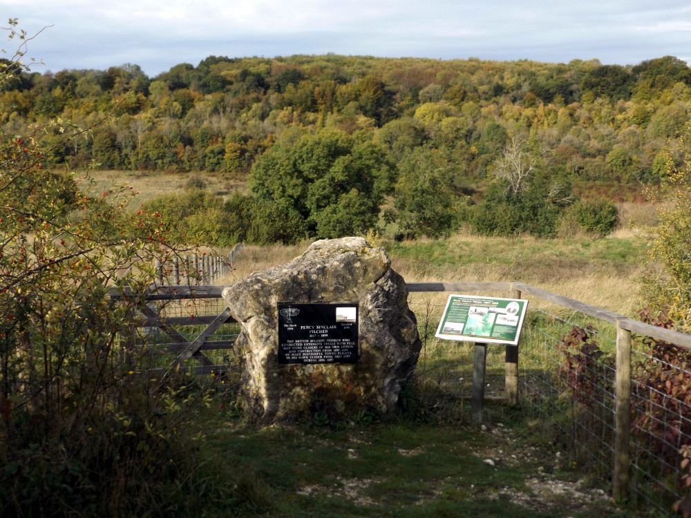
Opened in 2006, the monument marks the site of
pioneering experiments in manned flight undertaken by
Percy Pilcher in 1896 and 1897, initially using gliders.
He later designed and built a powered triplane but was
killed in a gliding accident in 1899 before he had the
opportunity to test it. Had he lived he might have
beaten the Wright Brothers to the first successful
powered flight.
Concrete Structures
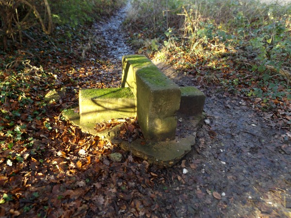
You will pass two or three of these on the walk.
They are the remains of unusual stiles dating back
before, possibly well before, 1964 when they were
mentioned in a London Transport book of "Country Walks".
Public Transport
The walk is ideal for travelling by train to Shoreham
Station on the route from Victoria to Maidstone or St
Pancras and City Thameslink to Sevenoaks.
Fox and Hounds
This pub at Romney Street which you may find marked
on your Ordnance Survey map is no longer open.
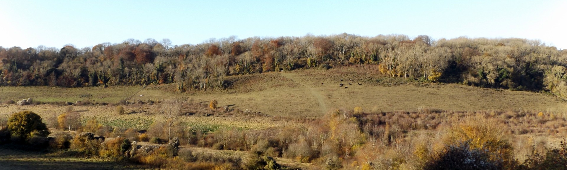
Austin Lodge Valley
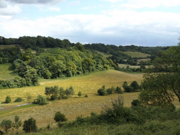
This charming valley, now dry, was probably formed in
the white chalk of the North Downs during the most
recent glacial period. There were no glaciers here
but the climate was cold enough to freeze any moisture
in the chalk, making it impermeable to water so that
during periods of surface thaw the water would form a
stream that cut the valley into the chalk. In
modern times the chalk is permeable to water so that
streams cannot form. As the chalk gradually
dissolved and washed away there were left behind flints
which had been suspended within the chalk and clay
formed from silt deposited with along with the shells of
tiny sea creatures when the chalk was laid down in clear
water. This “clay with flints” forms the
relatively thin soil of the valley.
Please report any problems with this walk to
info@kentramblers.org.uk.
Ramblers' volunteers in Kent work tirelessly to
ensure that our paths are as well protected and
maintained as possible. Of course we also organise
led walks but most of our members are independent
walkers who simply want to support our footpath work.
Please
join us and become a supporter too. You need
us and we really need you.
Map contains Ordnance Survey data © Crown copyright
and database rights 2020. Some paths on map are based
on data provided by Kent County Council but do not
constitute legal evidence of the line of a right of way |