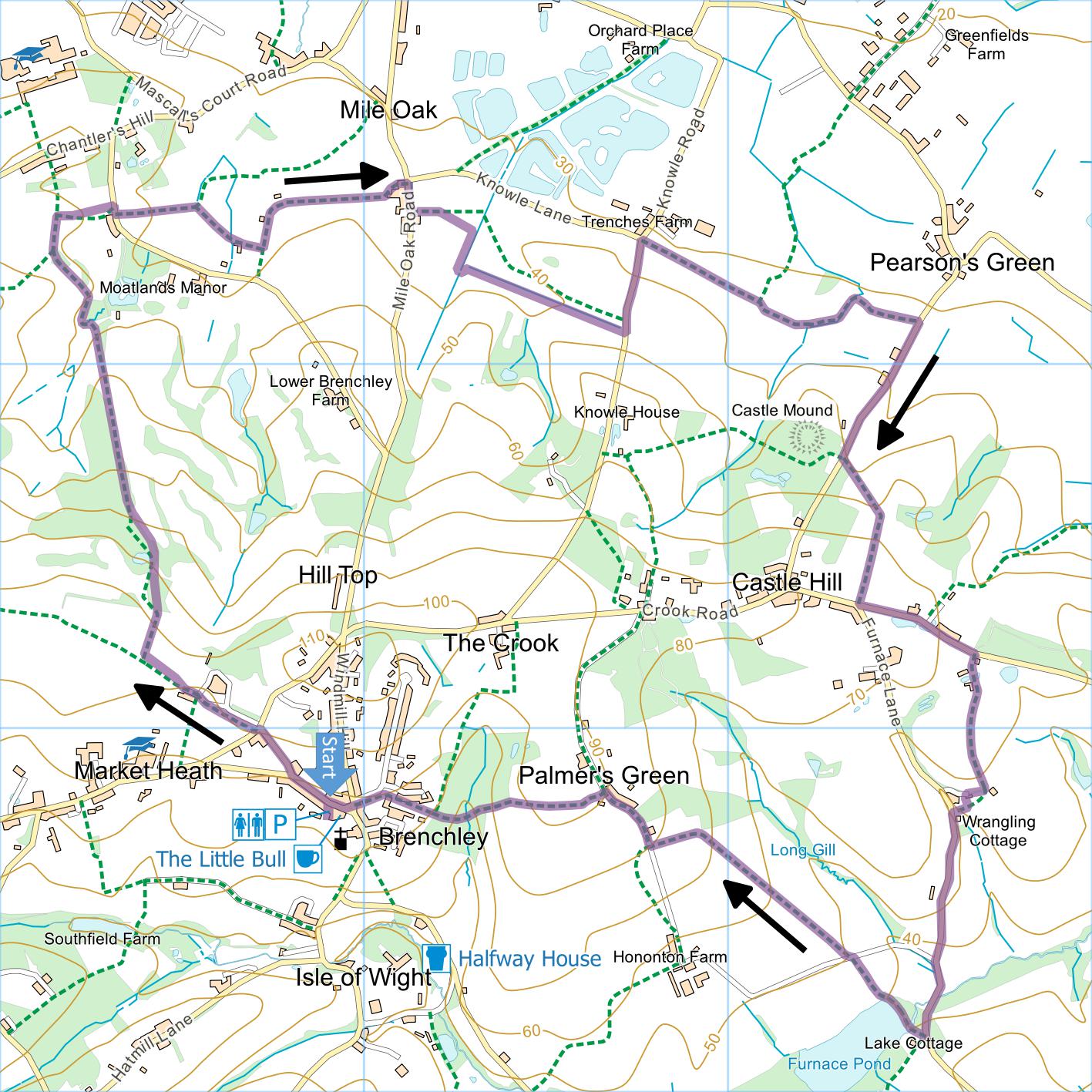
Brenchley and Mile Oak
Distance: 6.1 Miles (3.0
Hours)
OS Map: Explorer 136
(Start at grid reference TQ679417)
Click map to enlarge and click
again to enlarge further
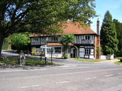
Park in small car park in Brenchley. If
approaching from Matfield it is down short lane on right
just after old forge and just before Bull Inn.
There are toilets. If car park is full, there are
more parking spaces near the church.
Emerge from car park into High Street and turn left.
On reaching war memorial, turn right up Holly Bank.
At top turn left but almost immediately take path up
steps on right into orchard. Soon go through gate
on right and then bear left along drive past houses.
Enter orchard, turn right and after a few metres left
along grassy track.
After 100 metres immediately before meadow begins on
right, turn right down path with orchard on right and
meadow on left. Go through gate and follow path
across former golf course, soon between fences.
Continue to bottom of hill and follow path round to left
of copse. At T-junction turn right downhill.
After lowest point, head uphill again and just over brow
of hill take path on right between fences down to
Waterman’s Lane.
Turn right and after just a few metres take path on
left across field. At end of hedge sticking out
into field, path branches – bear right across field then
along edge of garden to track. Turn left and
follow, soon bearing right, to reach Mile Oak Road.
Turn right and, just past Mile Oak sign, take path on
left. Go up drive of house, through gate, along
edge of back garden and over stile into field.
When you reach ditch in middle of field, turn right
alongside it until, just after junction with another
ditch, cross first ditch on left and follow right hand
bank of second ditch to Knowle Road. (Path as
marked on OS map follows rather different route across
the field.)
Turn left down lane to junction. Turn right
along path beside fence then across field to footbridge.
Cross next field, initially towards house then bearing
left along far field edge to footbridge. Across
bridge, turn left along field edge then track to
Pearson’s Green Road.
Turn right past several houses until you reach a
clearly signposted path on left. Down steps bear
right across field to top right corner (if ploughed you
may prefer to go along right hand edge). Turn
right along track uphill through meadow making for
buildings at top of hill and emerge onto Crook Road.
Turn left for 300m the turn right along driveway
leading past Temple Farm and Little Crossletts (there is
a small concrete footpath sign in verge). Follow
past house into open field, bear right and follow right
hand edge of field, becoming path between hedges after
large dung heap. Go over stile into garden of
house, turn right along drive then, just before metal
gates, go left along right hand side and then back of
garage. Follow path down steps, over stile then
down to Furnace Lane.
There is now a section of road walking. Take
especial care and be sure to walk on the outside of
blind bends. Continue to lowest point of road and
then as it turns a corner and starts to climb take a
path on right just after a small lay-by. Keep
right and cross end of lake (Furnace Pond – a relic of
the Weald’s ancient iron industry). Through gate,
turn right uphill through orchard. Bear slightly
left across track to pass yellow waymark. As you
near a wood at top of orchard, bear left straight across
orchard to a lane. Turn right and take path on
left immediately after bungalow on left. Follow
along field edge down to where old railway sleepers have
been laid to avoid the mud. Once across the
sleepers go steeply uphill to stile at top and along
path that brings you out opposite the church in
Brenchley. Cross the green and bear right along
High Street past former Bull Inn to car park entrance.
.
|
Points of Interest
Brenchley
Brenchley originally prospered through the cloth
trade, then became a centre for the iron industry and
later hops.
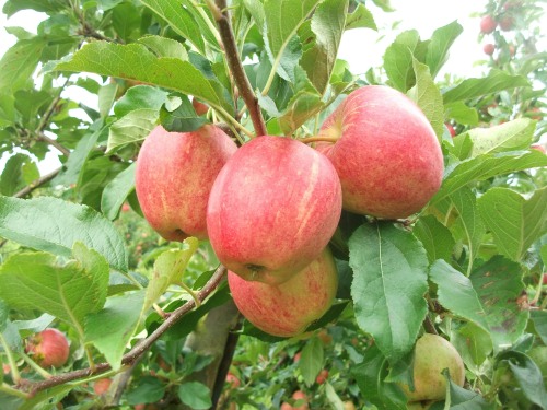
Orchards, once in decline, are now seeing a
substantial revival and you will pass many recently
planted apple trees on this walk.
Castle Hill
There are the remains of a medieval ringwork castle
as indicated on the map. Ringwork castles were
typically built in the 11th and 12th centuries as
alternatives to Motte and Bailey castles – the choice
being based on topography and geology rather than wealth
or status. A typical ringwork consisted of a
simple earth bank, often topped with a wooden palisade,
surrounded by a ditch (from which the earth had been
taken to create the bank). At this site the main
bank was around 70 metres wide and there was a second,
smaller bank outside the ditch. There would have
been wooden buildings within the defences.
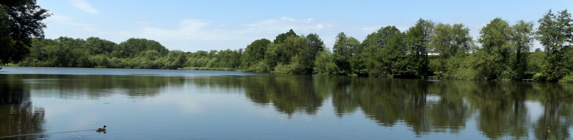
Furnace Pond
Water from this pond once pond once powered one of
the largest iron works in the Weald employing over 200
men. In 1614 its owner, John Brown, was granted
the monopoly of making iron and brass guns for the navy.
Public Transport
Brenchley can be reached by public transport from
Tunbridge Wells – service 297 runs every couple of hours
but not on Sundays.
In addition to the walking routes on our web site we
have published three popular walking guides:

Guide to Tunbridge
Wells Circular Walk and other walks in the area

Guide to the
Kent Coast Path: Part 1, Camber to Ramsgate
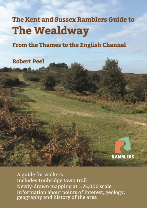
Guide to the Wealdway
Please report any problems with this walk to
info@kentramblers.org.uk.
Ramblers' volunteers in Kent work tirelessly to
ensure that our paths are as well protected and
maintained as possible. Of course we also organise
led walks but most of our members are independent
walkers who simply want to support our footpath work.
Please
join us and become a supporter too. You need
us and we really need you.
Map contains Ordnance Survey data © Crown copyright
and database rights 2025. Some paths on map are based
on data provided by Kent County Council but do not
constitute legal evidence of the line of a right of way |