Stubbs Wood and Whitley Forest
Distance: 5.9 Miles (2 Hours)
OS Map: Explorer 147 (Start at TQ496518)

Click map to magnify and click
again to magnify further
Park in the free Stubbs Wood car park at the top of
Yorks Hill.
Leave the car park at the entrance, cross Yorks Hill
to the footpath opposite and follow the Greensand Way
uphill. Pass seat with view on right and gate on
left then, when the path ahead rises steeply, bear right
downhill at first through and then along the edge of
woodland.
Emerging from the woodland, cross the top of a field
o a stile by a gate and after 50 metres (by an
electricity pole) bear right downhill into another wood.
On the far side, cross a field climbing slightly to a
gate at the edge of a wood. Cross the top of the
next field to the end of the wood on the left then cross
bridge and go through gate. Turn right along field
edge to gate into lane.
Turn left up lane and soon take path on right.
Follow left hand edge of field at first then at corner
bear slightly left across field to pass to right of
Wickhurst Manor. On reaching junction of drives,
turn left uphill (don’t follow Greensand Way over stile
on right) and continue uphill past large house on left.
As track levels and bears left, take track on right,
becoming a path, steeply uphill to lane. Turn
right then take path on left uphill to another lane.
Turn left and take first path (SR218) on right
through wood, avoiding all left turns, to lane.
Take metalled track opposite, descending gradually,
through woodland for nearly a mile. The track is
labelled “Goldsmith’s Bottom” on older maps but the
reason is not known. On reaching a gate into lane,
don’t go through but bear left and take another metalled
track climbing steadily through the woods. After
climbing for 500 metres or so, follow the track as it
bears right and levels out, crosses a broader track and
becomes a path descending to a T-junction with a broader
track. Turn left downhill and shortly right across
footbridge over stream leaving a large pond. There
used to be a mill here and presumably the pond supplied
it with water – hence the wood behind being named “Mill
Bank Wood”.
Turn left and follow path, keeping left at all
junctions, climbing very gradually along narrow valley.
On reaching open area with pond on left (dried up at the
time of writing) turn right and go through metal kissing
gate into a wood. Turn left along a path that
initially runs parallel to the fence then bears right
uphill. On reaching a junction of several much
broader tracks, follow the one ahead to a junction of
seven paths by a water-filled circular brick structure.
Take the first metalled track on the left (actually the
second path but the first is only a narrow,
inconspicuous path), in due course descending into a
shallow valley and climbing out again, bearing left as
you do so. After a while there is an open field on
the left. When the track bears left look for a
path up a bank on the right opposite information board
and follow it to a lane.
Bear right to a path opposite and follow this, once
known as Lady Amherst's Drive, passing a seat with fine
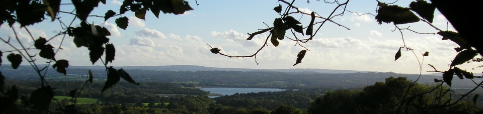
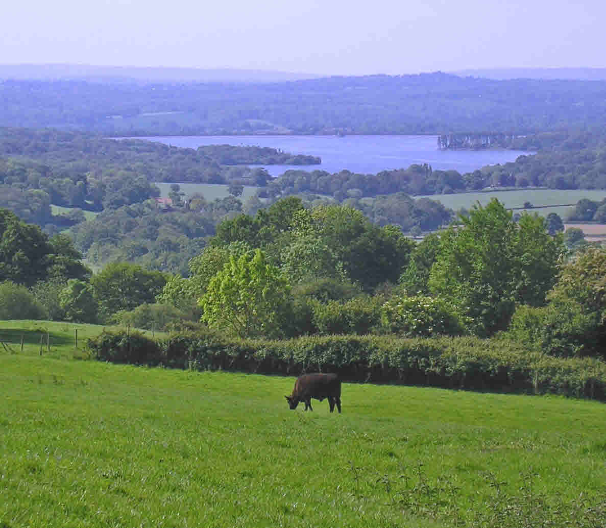
views of Bough Beech Reservoir, back to the car park.
|
Points of Interest
Everlands
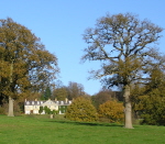
A late Georgian country house with later additions,
divided into three dwellings some time ago.
Lady Amherst's Drive
Sarah Amherst was the wife of William Amherst, 1st
Earl Amherst, who was Governor-General of India from
1823 to 1828. Born William Pitt Amherst, he inherited
the Montreal estate on the outskirts of nearby Sevenoaks
from his great uncle Jeffrey Amherst, 1st Baron Amherst,
who commanded the British forces in Canada who took
Quebec under General Wolf and Montreal – hence the name
of his estate. While Montreal was long ago demolished,
Wolf’s own Quebec House in nearby Westerham survives in
the hand of the National Trust. The Amhersts were
responsible for introducing the game bird known as Lady
Amherst’s pheasant from Asia to Bedfordshire. With
splendid feathers much sought after for fashion and
fishing, this pheasant is reared in captivity but is not
thought to be breeding in the wild in the UK. It is
closely enough related to the golden pheasant that the
two can interbreed and produce fertile hybrids.
Presumably Lady Amherst was fond of a drive along the
Greensand Ridge using the track that returns you to
Stubbs Wood, enjoying fine views across Kent. Of
course, Bough Beech Reservoir was not there then.
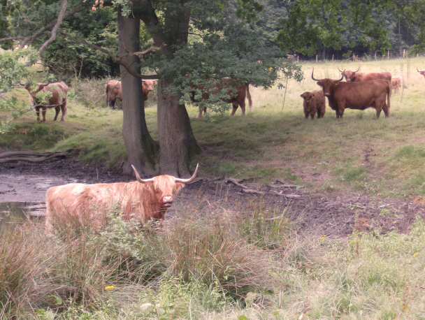
Highland Cattle in Whitley
Forest
In addition to the walking routes on our web site we
have published two popular walking guides:

Guide to the
Kent Coast Path: Part 1, Camber to Ramsgate

Guide to Three
River Valley Walks in West Kent: Darent Valley Path,
Eden Valley Walk and Medway Valley Walk
Please report any problems with this walk to
info@kentramblers.org.uk.
Ramblers' volunteers in Kent work tirelessly to
ensure that our paths are as well protected and
maintained as possible. Of course we also organise
led walks but most of our members are independent
walkers who simply want to support our footpath work.
Please
join us and become a supporter too. You need
us and we really need you.
Map contains Ordnance Survey data © Crown copyright
and database rights 2019. Some paths on map are based
on data provided by Kent County Council but do not
constitute legal evidence of the line of a right of way |