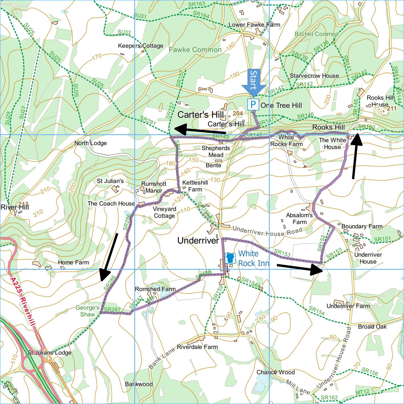
One Tree Hill and
Underriver
Distance:
4.5 Miles (2 Hours)
OS Map:
Explorer 147 (Start at TQ559532)
Click map to enlarge and click
again to enlarge further
Park in free car park at One Tree Hill, on road south
from Godden Green.
Leave car park by top corner, just to left of
information board. At T-junction with fine views
across Kent turn right downhill to road. Cross
over and turn left, very carefully. At first bend
take path to right of entrance to Shepherds Mead between
fences and along top of large field. At junction
of paths at corner of field, turn sharp left down sunken
track between hedges – may be muddy after rain.
At bottom, turn right past converted oast house.
Follow metalled track to sharp bend just beyond Coach
House on right. Do not follow main track bearing
right uphill but instead take stony track on left
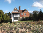
between hedges and follow past pond from which there are
fine views of St Julian’s, an early nineteenth century
mansion now used as a country club. After half a
mile or so, pass through narrow band of woodland.
Immediately after woodland on left ends, take path
through gate on left along left hand edge of field to
corner. Bear left and go over a stile beside a
gate.
Bear right across field to stile in hedge to right of
farm. Climb stile, cross private drive and climb
another stile into afield. Bear left across field,
passing large pond on left, go over stile by gate and
cross short field to second stile.
Continue straight ahead uphill passing just left of
electricity pole to edge of field and go through gate
onto enclosed track. Soon turn sharp right, cross
playing field alongside village hall and emerge on road
in attractive village of Underriver opposite church
(built 1865 by John Davison MP who then lived at
Underriver House). Turn left past the “The White
Rock” inn and immediately after The Forge take footpath
on right through two gates into field.
Initially follow hedge on right. When hedge
ends, continue forward to stile. Cross this stile
and bear slightly right uphill across the next field to
boundary ridge then in same line descend to second
boundary ridge and continue to stile at far side of
field. Cross next field to protruding corner of
hedge then on to stile in corner of field. Cross
next field towards another stile, but before you reach
it bear left and follow fence on right to another stile.
Once over this stile bear left across field aiming
somewhat to right of large dead ash tree and then to
stile in hedge. Climb stile into road and turn
left.
When road bends left and entrance to Absalom’s Farm
is straight ahead, take a lane (Rooks Hill) on the right
immediately before farm entrance. Continue up lane
until, just past entrance to White House, there is
woodland on left. Soon after start of woodland
take clearly signposted footpath on left. Continue
past entrance to White Rocks Farm Boarding Kennels.
Follow access drive to kennels, avoiding all left turns,
to reach road opposite where you left it near start of
walk.
Taking great care on short section of road, turn
right and then right into wood retracing your steps back
to car park.
In addition to the walking routes on our web site we
have published four popular walking guides:
|
Points of Interest
One Tree Hill
According to the information board, this site was
just a couple of fields separated by a few trees prior
to 1911, which may explain its name. It was
severely affected by the 1987 storm but has recovered
rapidly. There are plenty of trees now.
Underriver
The name is derived from “sub le ryver” meaning
“under the hill”. The village was called “The
Golden Valley” by Samuel Palmer, the painter who lived
for a time at Shoreham. The village has its own
web site:
www.underriver-village.org.uk.
Romshed Farm
Like the village of Underriver, the original
Romschedde was probably settled because it lies where
the bottom of the greensand beds meet the Wealden clay
resulting in a series of springs that ensure a reliable
water supply. Romshed Farm is an organic farm
seeking to conserve the traditional landscape of small
fields, hedgerows and belts of ancient woodland.
Public Transport
Bus service 204 runs from Tonbridge to Underriver
where you could start and finish the walk. It is
infrequent and does not run at weekends or Wednesdays
but if you take the 10:00 bus out and the 13:31 back you
will have plenty of time for the walk.
Please report any problems with this walk to
info@kentramblers.org.uk.
Ramblers' volunteers in Kent work tirelessly to
ensure that our paths are as well protected and
maintained as possible. Of course we also organise
led walks but most of our members are independent
walkers who simply want to support our footpath work.
Please
join us and become a supporter too. You need
us and we really need you.
Map contains Ordnance Survey data © Crown copyright
and database rights 2023. Some paths on map are based
on data provided by Kent County Council but do not
constitute legal evidence of the line of a right of way.
|